Latitude: 51.1683 / 51°10'5"N
Longitude: -1.7757 / 1°46'32"W
OS Eastings: 415777
OS Northings: 141031
OS Grid: SU157410
Mapcode National: GBR 503.MVX
Mapcode Global: VHB5C.5WLR
Plus Code: 9C3W569F+8P
Entry Name: Toll House
Listing Date: 26 May 1976
Grade: II
Source: Historic England
Source ID: 1131068
English Heritage Legacy ID: 321377
ID on this website: 101131068
AMESBURY SALISBURY ROAD SU 1541 (south-west side) 11/66 Toll House 26.5.76
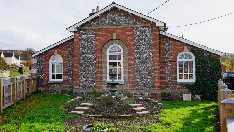
- II Toll house on new turnpike to Old Castle passing on east, and to Old Salisbury Road passing to west. 1836, for Swindon Marlborough and Everleigh Turnpike Trust. Flint with brick quoins and dressings, plinth of uncut flints, slate roof. Central gabled block set at angle facing road to north, with C20 central arch headed window in a brick dressed opening, and keystone to brick arch. Eaves carried on shaped brackets. On either side, set back, lean-to sections also with arch headed windows with brick dressings. Sides and rear rendered, and C20 addition to rear. Brick stack. (Chandler J. and Goodhugh: Amesbury - "History and Description of a South Wiltshire town", 1979
Listing NGR: SU1577741031
External links are from the relevant listing authority and, where applicable, Wikidata. Wikidata IDs may be related buildings as well as this specific building. If you want to add or update a link, you will need to do so by editing the Wikidata entry.


Other nearby listed buildings