Latitude: 53.3334 / 53°20'0"N
Longitude: -2.6959 / 2°41'45"W
OS Eastings: 353751
OS Northings: 382056
OS Grid: SJ537820
Mapcode National: GBR 9YMW.4S
Mapcode Global: WH87R.KGFX
Plus Code: 9C5V88M3+9J
Entry Name: Halton Castle
Listing Date: 23 April 1970
Grade: I
Source: Historic England
Source ID: 1130460
English Heritage Legacy ID: 55981
ID on this website: 101130460
Location: The Brow, Halton, Cheshire, WA7
County: Halton
Electoral Ward/Division: Castlefields
Parish: Non Civil Parish
Built-Up Area: Runcorn
Traditional County: Cheshire
Lieutenancy Area (Ceremonial County): Cheshire
Church of England Parish: Halton St Mary
Church of England Diocese: Chester
SJ 58 SW HALTON CASTLE ROAD 5/28 Halton Castle
23.4.70 I
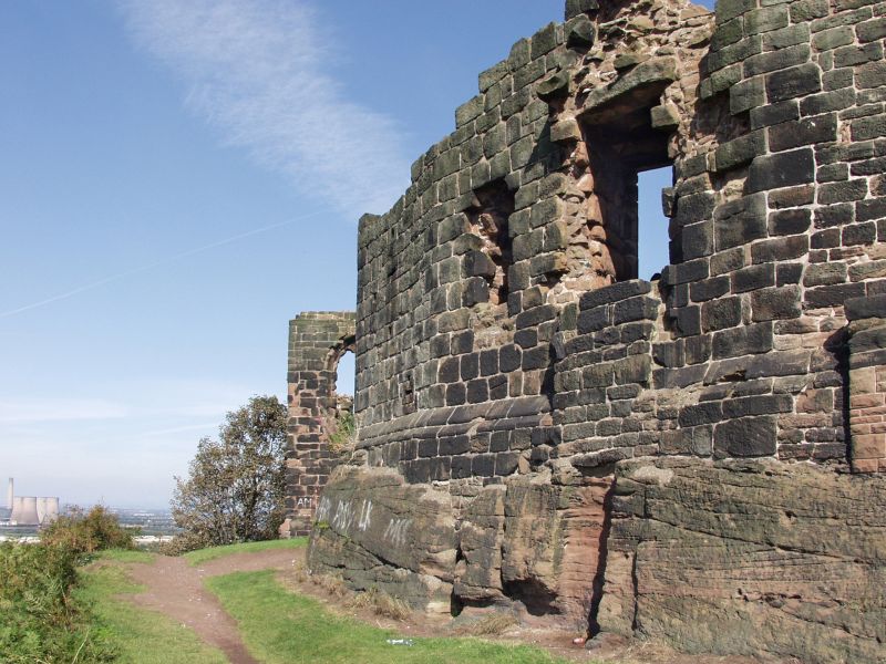
Ruinous Castle circa 1070 for Nigel first Norman Baron of Halton. Red sandstone almost eliptical on plan sitting on top of high sandstone and earth mound and dominating the surrounding plain. Roughly squared sandstone inner and outer faces with corework infilling. A few high standing sections of the walls contain the remains of windows with tracery which suggests a late medieval alteration. High standing remains within the walls South East were built C1800 to make the Castle an eyecatcher from Norton Priory. Scheduled Ancient Monument.
Listing NGR: SJ5375182056
External links are from the relevant listing authority and, where applicable, Wikidata. Wikidata IDs may be related buildings as well as this specific building. If you want to add or update a link, you will need to do so by editing the Wikidata entry.


Other nearby listed buildings