Latitude: 53.3329 / 53°19'58"N
Longitude: -2.6975 / 2°41'50"W
OS Eastings: 353647
OS Northings: 382004
OS Grid: SJ536820
Mapcode National: GBR 9YLW.SY
Mapcode Global: WH87R.JHP8
Plus Code: 9C5V88M3+52
Entry Name: Village Farmhouse
Listing Date: 31 October 1983
Grade: II
Source: Historic England
Source ID: 1115509
English Heritage Legacy ID: 55991
ID on this website: 101115509
Location: The Brow, Halton, Cheshire, WA7
County: Halton
Electoral Ward/Division: Castlefields
Parish: Non Civil Parish
Built-Up Area: Runcorn
Traditional County: Cheshire
Lieutenancy Area (Ceremonial County): Cheshire
Church of England Parish: Halton St Mary
Church of England Diocese: Chester
Tagged with: Farmhouse
SJ 58 SW HALTON MAIN STREET (West Side)
5/38 No.45 (Village Farm House)
II
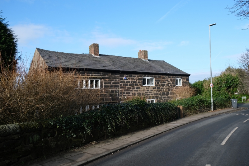
Farm house now cottage early C17 with alterations and additions, sandstone with slate roof. 2 storey 1 bay, coursed rubble walls, mullion windows with leaded lights. String courses at first floor level and above first floor window. Later section north, in random rubble with casement windows, of no interest.
Listing NGR: SJ5364782004
External links are from the relevant listing authority and, where applicable, Wikidata. Wikidata IDs may be related buildings as well as this specific building. If you want to add or update a link, you will need to do so by editing the Wikidata entry.


Other nearby listed buildings