Latitude: 51.9512 / 51°57'4"N
Longitude: -0.5335 / 0°32'0"W
OS Eastings: 500879
OS Northings: 229089
OS Grid: TL008290
Mapcode National: GBR G46.PXT
Mapcode Global: VHFR5.P7S2
Plus Code: 9C3XXF28+FH
Entry Name: St James
Listing Date: 26 September 1980
Grade: II
Source: Historic England
Source ID: 1114761
English Heritage Legacy ID: 36148
ID on this website: 101114761
Location: Toddington, Central Bedfordshire, LU5
County: Central Bedfordshire
Civil Parish: Toddington
Built-Up Area: Toddington
Traditional County: Bedfordshire
Lieutenancy Area (Ceremonial County): Bedfordshire
Church of England Parish: Toddington
Church of England Diocese: St.Albans
Tagged with: Building
1. 5125 TODDINGTON PARK ROAD (north side)
St James SP 0029 18/359
II
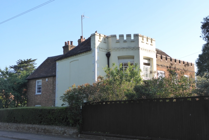
2. C18 core, but mainly C19. T-plan. Main gable end to road, roughcast. Two storeys. Hipped old clay tile roof. Castellated parapet. Two storey castellated bay to left of east front, 3 sash windows to right. Gabled 2 storey rear wing. East section of red stretchers and vitrified headers. West section red brick has 2 sash windows with glazing bars.
Listing NGR: TL0087929089
External links are from the relevant listing authority and, where applicable, Wikidata. Wikidata IDs may be related buildings as well as this specific building. If you want to add or update a link, you will need to do so by editing the Wikidata entry.


Other nearby listed buildings