Latitude: 53.3309 / 53°19'51"N
Longitude: -1.6513 / 1°39'4"W
OS Eastings: 423316
OS Northings: 381612
OS Grid: SK233816
Mapcode National: GBR JYXX.8P
Mapcode Global: WHCCN.LJVT
Plus Code: 9C5W88JX+9F
Entry Name: Outbuilding to the South South West of Hathersage Hall
Listing Date: 12 July 1967
Grade: II
Source: Historic England
Source ID: 1109803
English Heritage Legacy ID: 81190
Also known as: The Dovecote
ID on this website: 101109803
Location: Hathersage, Derbyshire Dales, Derbyshire, S32
County: Derbyshire
District: Derbyshire Dales
Civil Parish: Hathersage
Built-Up Area: Hathersage
Traditional County: Derbyshire
Lieutenancy Area (Ceremonial County): Derbyshire
Church of England Parish: Hathersage St Michael and All Angels
Church of England Diocese: Derby
Tagged with: Office building Appendage
SK 23 81 PARISH OF HATHERSAGE MAIN ROAD (off) 6/41 12.7.67 Outbuilding to the south south west of Hathersage Hall (formerly listed as Outbuildings at the Hall) GV II
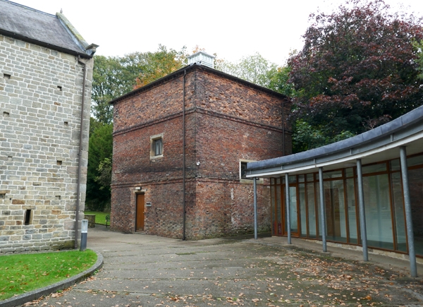
Farm outbuilding. c1800. Red brick with dentilled eaves and pyramidal stone slated roof with lead rolls, surmounted by louvred lantern with pyramidal leaded roof. Square in plan, two storey and attics, with broad band courses to first and second floors. South east elevation with stone framed Diocletian window to first floor, north west elevation with stone framed opening to first floor and carriage entrance with depressed segmental arch to ground floor of north east elevation. Listed for group value only.
Listing NGR: SK2331681612
External links are from the relevant listing authority and, where applicable, Wikidata. Wikidata IDs may be related buildings as well as this specific building. If you want to add or update a link, you will need to do so by editing the Wikidata entry.


Other nearby listed buildings