Latitude: 51.9256 / 51°55'32"N
Longitude: -0.01 / 0°0'36"W
OS Eastings: 536934
OS Northings: 227107
OS Grid: TL369271
Mapcode National: GBR K98.B90
Mapcode Global: VHGNX.SV2P
Plus Code: 9C3XWXGQ+7X
Entry Name: Woolpack Croft
Listing Date: 22 February 1967
Grade: II
Source: Historic England
Source ID: 1102243
English Heritage Legacy ID: 161376
ID on this website: 101102243
Location: Westmill, East Hertfordshire, SG9
County: Hertfordshire
District: East Hertfordshire
Civil Parish: Westmill
Traditional County: Hertfordshire
Lieutenancy Area (Ceremonial County): Hertfordshire
Church of England Parish: Westmill
Church of England Diocese: St.Albans
Tagged with: Building Thatched cottage
Westmill village TL 3627 WESTMILL HIGH STREET (south side)
8/21 Woolpack Croft
22.2.67
GV II
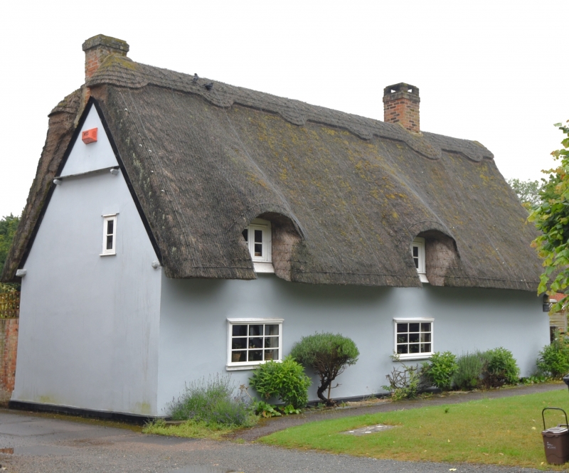
House. C17 or earlier. Timber frame plastered with steep thatched roof. 3-unit plan house with central chimney a third from W end and internal gable chimney at E end. One and a half storeys house along street. Eyebrow dormers with 2-light casement windows at eaves, 2 on N (in middle and E part) and in middle on S. 2 3-light flush casement windows below dormers on N front. Entrance now at rear. Windows in W end. Side-purlin roof with drip-board across purlin-ends on E gable. Interior: chamfered axial beams and exposed joists, straight tension braces, and chamfered lintol to wide fireplace. C20 block at to rear not of special interest.
Listing NGR: TL3693427107
External links are from the relevant listing authority and, where applicable, Wikidata. Wikidata IDs may be related buildings as well as this specific building. If you want to add or update a link, you will need to do so by editing the Wikidata entry.


Other nearby listed buildings