Latitude: 52.1773 / 52°10'38"N
Longitude: -2.2571 / 2°15'25"W
OS Eastings: 382518
OS Northings: 253260
OS Grid: SO825532
Mapcode National: GBR 1G9.D5X
Mapcode Global: VH92S.TJNQ
Plus Code: 9C4V5PGV+W5
Entry Name: Stanfield House
Listing Date: 29 July 1959
Grade: II
Source: Historic England
Source ID: 1098717
English Heritage Legacy ID: 153448
ID on this website: 101098717
Location: Upper Wick, Malvern Hills, Worcestershire, WR2
County: Worcestershire
District: Malvern Hills
Civil Parish: Rushwick
Traditional County: Worcestershire
Lieutenancy Area (Ceremonial County): Worcestershire
Church of England Parish: Crown East, Rushwick
Church of England Diocese: Worcester
Tagged with: House
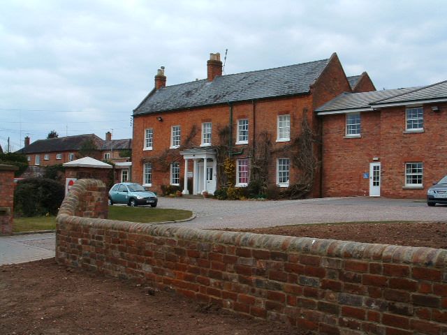
RUSHWICK CP UPPER WICK SO 85 SW 3/130 Stanfield House 29.7.59 - II House. Circa 1800, extended early to mid-C19. Brick in Flemish bond with slate roof. Two storeys, five bays. The windows have gauged brick heads except for those of the two left-hand bays: a straight joint suggests that these are a later addition. The windows are sashed, with no glazing bars on the ground floor and with glazing bars on the first floor. The doorway has an elliptical fanlight above a fluted frieze with paterae which is supported on Tuscan columns. The timber porch has an entablature supported by influted columns with Greek Doric capitals. Brick dentil course at eaves, and gable parapets. Chimneys on gables and to left of doorway. At the rear is a timber bow window which has sashes with glazing bars.
Listing NGR: SO8251853260
External links are from the relevant listing authority and, where applicable, Wikidata. Wikidata IDs may be related buildings as well as this specific building. If you want to add or update a link, you will need to do so by editing the Wikidata entry.


Other nearby listed buildings