Latitude: 51.8523 / 51°51'8"N
Longitude: -1.7488 / 1°44'55"W
OS Eastings: 417395
OS Northings: 217104
OS Grid: SP173171
Mapcode National: GBR 4QT.W45
Mapcode Global: VHB22.MPTX
Plus Code: 9C3WV722+WF
Entry Name: Broadmoor Farmhouse
Listing Date: 25 March 1987
Grade: II
Source: Historic England
Source ID: 1090462
English Heritage Legacy ID: 130588
ID on this website: 101090462
Location: Cotswold, Gloucestershire, GL54
County: Gloucestershire
District: Cotswold
Civil Parish: Sherborne
Traditional County: Gloucestershire
Lieutenancy Area (Ceremonial County): Gloucestershire
Church of England Parish: Sherborne St Mary Magdalene
Church of England Diocese: Gloucester
Tagged with: Farmhouse
SHERBORNE SP 11 NE 2/151 Broadmoor Farmhouse GV II
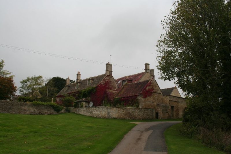
Detached farmhouse. Mid C17, partly rebuilt and extended C19. Coursed, squared and dressed limestone with dressed alternate quoins. Stone slate roof to main body, red tile to C19 extension with ashlar stacks restored C20. Complex plan. Four-windowed facade to main body. Moulded plinth. Two storeys and attic lit by 3 hipped roof dormers with 4-pane sashes. Three and 4-light stone-mullioned casements the latter with king mullions. Five- light canted bay to left. Rectangular bay lit by 4-pane sashes to right, two 4-pane sashes above. Gabled porch off-centre left, between bays with C20 door with fillets within basket-headed moulded surrounds. Band between floors. C19 extensions to right. Forward facing gable left with 4-light stone-mullioned casement. Three-light stone-mullioned casement to outbuilding on right. Earliest part of house visible at rear. Moulded plinth. Two-light hollow-chamfered stone-mullioned casement right of C19 four-panelled door. Two and 3-light stone-mullioned casements with flat-chamfered jambs also. Band between floors. Interior not inspected.
Listing NGR: SP1739517104
External links are from the relevant listing authority and, where applicable, Wikidata. Wikidata IDs may be related buildings as well as this specific building. If you want to add or update a link, you will need to do so by editing the Wikidata entry.


Other nearby listed buildings