Latitude: 51.9628 / 51°57'45"N
Longitude: -1.7408 / 1°44'26"W
OS Eastings: 417905
OS Northings: 229397
OS Grid: SP179293
Mapcode National: GBR 4PG.YGY
Mapcode Global: VHB1H.SX2Q
Plus Code: 9C3WX775+4M
Entry Name: The Place
Listing Date: 30 January 1987
Grade: II
Source: Historic England
Source ID: 1089770
English Heritage Legacy ID: 130262
ID on this website: 101089770
Location: Longborough, Cotswold, Gloucestershire, GL56
County: Gloucestershire
District: Cotswold
Civil Parish: Longborough
Built-Up Area: Longborough
Traditional County: Gloucestershire
Lieutenancy Area (Ceremonial County): Gloucestershire
Church of England Parish: Longborough with Sezincote
Church of England Diocese: Gloucester
Tagged with: Building
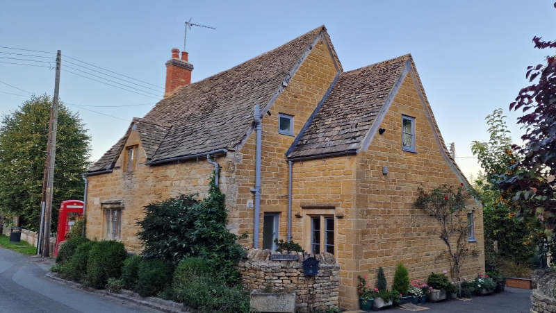
LONGBOROUGH LONGBOROUGH VILLAGE SP 1729 8/149 The Place GV II Detached cottage. Late C17 - early C18 and C20. Coursed squared and dressed limestone, stone slate roof, brick stack. Rectangular main body with C20 extension onto right gable end. Main body 1 1/2 storeys with full dormer off-centre right lit by a 2-light double- chamfered, stone-mullioned casement, 3-light, double-chamfered stone-mullioned casement with stopped hood. All casements with horizontal glazing bars. C19 plank door at rear. Flat roof to C20 extension right. Brick left gable-end stack. Interior not inspected.
Listing NGR: SP1790529397
External links are from the relevant listing authority and, where applicable, Wikidata. Wikidata IDs may be related buildings as well as this specific building. If you want to add or update a link, you will need to do so by editing the Wikidata entry.


Other nearby listed buildings