Latitude: 51.9898 / 51°59'23"N
Longitude: -1.7018 / 1°42'6"W
OS Eastings: 420571
OS Northings: 232416
OS Grid: SP205324
Mapcode National: GBR 4PB.8JK
Mapcode Global: VHBYZ.G75Y
Plus Code: 9C3WX7QX+W7
Entry Name: Cotswold House
Listing Date: 30 June 1983
Grade: II
Source: Historic England
Source ID: 1088628
English Heritage Legacy ID: 126727
ID on this website: 101088628
Location: Moreton-in-Marsh, Cotswold, Gloucestershire, GL56
County: Gloucestershire
District: Cotswold
Civil Parish: Moreton-in-Marsh
Built-Up Area: Moreton-in-Marsh
Traditional County: Gloucestershire
Lieutenancy Area (Ceremonial County): Gloucestershire
Church of England Parish: Moreton-in-Marsh St David
Church of England Diocese: Gloucester
Tagged with: House
This list entry was subject to a Minor Amendment on 25 September 2024 to update the name, address and reformat the text to current standards
SP 2032 SE
2/74
MORETON-IN-THE-MARSH
OXFORD STREET (south side)
Cotswold House
(Formerly listed as Bengal House)
GV
II
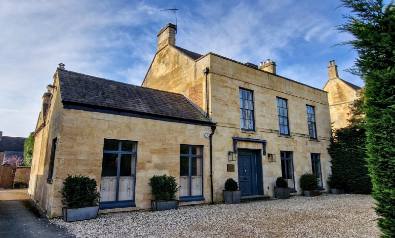
Early C19. Ashlar with Welsh slate roof. Two storeys and attic, three windows, panel casements below, sashes with glazing bars above, cill band. Part glazed double doors with bracketted hood on left. Parapet band, coped parapet. Roof with stone verges, flat topped central dormer and ashlar end stacks. Two bay later wing to left, single storey.
Interior has semi-elliptical headed niches flanking (modern) fireplace in hall; behind is staircase with enriched tread ends and enriched cornice. Fleur-de-lis railings to road, single storey wing to rear with two windows and slate roof.
Listing NGR: SP2057132416
External links are from the relevant listing authority and, where applicable, Wikidata. Wikidata IDs may be related buildings as well as this specific building. If you want to add or update a link, you will need to do so by editing the Wikidata entry.


Other nearby listed buildings