Latitude: 53.3131 / 53°18'47"N
Longitude: -1.3514 / 1°21'5"W
OS Eastings: 443309
OS Northings: 379772
OS Grid: SK433797
Mapcode National: GBR MZ04.61
Mapcode Global: WHDDY.6ZQG
Plus Code: 9C5W8J7X+6C
Entry Name: 28, Church Street
Listing Date: 7 July 1989
Grade: II
Source: Historic England
Source ID: 1087779
English Heritage Legacy ID: 79543
ID on this website: 101087779
Location: Eckington, North East Derbyshire, S21
County: Derbyshire
District: North East Derbyshire
Civil Parish: Eckington
Built-Up Area: Eckington
Traditional County: Derbyshire
Lieutenancy Area (Ceremonial County): Derbyshire
Church of England Parish: Eckington and Ridgeway
Church of England Diocese: Derby
Tagged with: Building
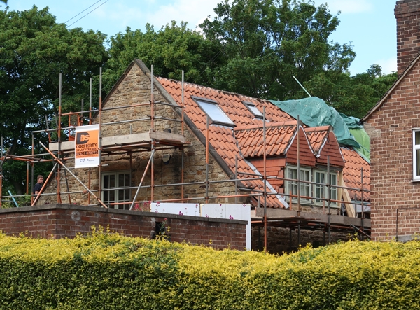
PARISH OF ECKINGTON CHURCH STREET SK 42/4379 11/70 No 28 Church Street II House, formerly barn. Early C16 or earlier with C17 alterations and additions and converted in 1975. Coursed rubble coal measures sandstone with quoins, coped gables and moulded kneelers, and an interlocking pantile roof. West elevation. Single storey and attics, four bays, with wide central opening now a garage door with a doorway and window opening to the south, beneath plain stone lintels. Four C20 gabled dormers to roof, the two central ones hipped. The interior contains two massive full height cruck trusses, which rise from padstones, within the walls. The trusses with yokes and collar beams have lost their tie beams, and support a ridge purlin and single purlins trenches into the backs of the principals. Substantial curved windbraces are dovetail lap-jointed onto the cruck blades.
Listing NGR: SK4331079772
External links are from the relevant listing authority and, where applicable, Wikidata. Wikidata IDs may be related buildings as well as this specific building. If you want to add or update a link, you will need to do so by editing the Wikidata entry.


Other nearby listed buildings