Latitude: 54.2372 / 54°14'13"N
Longitude: -2.5804 / 2°34'49"W
OS Eastings: 362265
OS Northings: 482545
OS Grid: SD622825
Mapcode National: GBR BMFF.4V
Mapcode Global: WH94H.BRGK
Plus Code: 9C6V6CP9+VR
Entry Name: Hodge Bridge
Listing Date: 21 November 1952
Grade: II
Source: Historic England
Source ID: 1086926
English Heritage Legacy ID: 75586
ID on this website: 101086926
Location: Barbon, Westmorland and Furness, Cumbria, LA6
County: Westmorland and Furness
District: South Lakeland
Civil Parish: Barbon
Traditional County: Westmorland
Lieutenancy Area (Ceremonial County): Cumbria
Church of England Parish: Kirkby Lonsdale Team Ministry
Church of England Diocese: Carlisle
SD 68 SW BARBON A683
16/6 Hodge Bridge 21.11.52
II
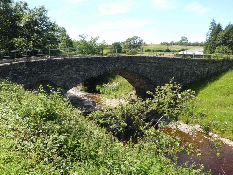
Bridge. Probably C18 with later parapets and widening. Stone rubble with dressed coping. Slightly pointed segmental arch with thin rough voussoirs. Southern approach widened on squinch arches, that to west probably C18, that to east probably C19. Low parapet has reeded coping and plain iron railings. Stream bed below bridge is paved, with further paving to west (downstream).
Listing NGR: SD6226582545


Other nearby listed buildings