Latitude: 51.3277 / 51°19'39"N
Longitude: 1.4215 / 1°25'17"E
OS Eastings: 638461
OS Northings: 164290
OS Grid: TR384642
Mapcode National: GBR X0M.L77
Mapcode Global: VHMCW.LWBL
Plus Code: 9F338CHC+3H
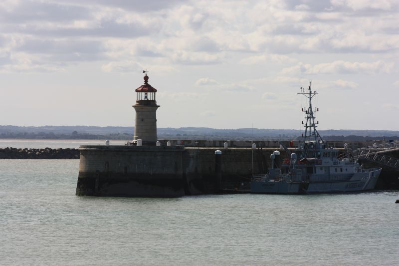
Entry Name: Lighthouse on West Pier
Listing Date: 30 October 1985
Grade: II
Source: Historic England
Source ID: 1086089
English Heritage Legacy ID: 171985
ID on this website: 101086089
Location: Ramsgate, Thanet, Kent, CT11
County: Kent
District: Thanet
Civil Parish: Ramsgate
Built-Up Area: Ramsgate
Traditional County: Kent
Lieutenancy Area (Ceremonial County): Kent
Tagged with: Lighthouse
RAMSGATE ROYAL HARBOUR TR 3864 SW 19/349 Lighthouse on West Pier 30.10.85 GV II Lighthouse. 1842 by John Shaw. Cornish granite, glass and iron. Cylindrical column of granite with moulded base and entablature, the frieze inscribed 3 times: Perfugium Miseris. South western doorway with 3 panel iron door and date stone over: AD MD CCCXCII. Octagonal glass lantern with iron cornice ornamented with shells, and with ball finial and weather vane. Contains 150 watt lamp with stepped lens with light range of 7 miles. Replaced an earlier Benjamin Wyatt lighthouse which had been too close to the pier head, and damaged by overhanging ships masts. (Busson, Cap. 3; Matkin, Maritime Thanet).
Listing NGR: TR3846164290
External links are from the relevant listing authority and, where applicable, Wikidata. Wikidata IDs may be related buildings as well as this specific building. If you want to add or update a link, you will need to do so by editing the Wikidata entry.


Other nearby listed buildings