Latitude: 51.3298 / 51°19'47"N
Longitude: 1.4165 / 1°24'59"E
OS Eastings: 638106
OS Northings: 164506
OS Grid: TR381645
Mapcode National: GBR X0L.JYJ
Mapcode Global: VHMCW.HTQZ
Plus Code: 9F338CH8+WJ
Entry Name: Jacob's Ladder
Listing Date: 30 October 1985
Grade: II
Source: Historic England
Source ID: 1031336
English Heritage Legacy ID: 171991
ID on this website: 101031336
Location: Ramsgate, Thanet, Kent, CT11
County: Kent
District: Thanet
Civil Parish: Ramsgate
Built-Up Area: Ramsgate
Traditional County: Kent
Lieutenancy Area (Ceremonial County): Kent
Tagged with: Stairs
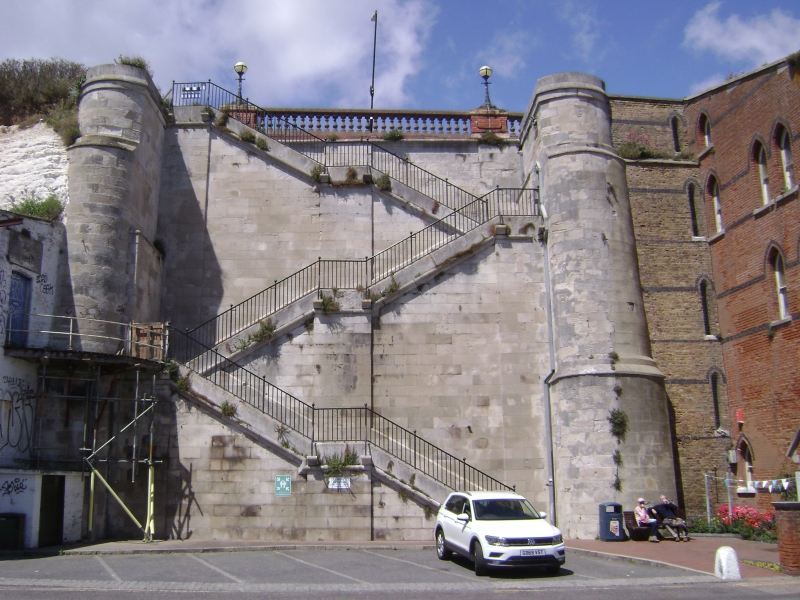
RAMSGATE ROYAL HARBOUR TR 3864 NW (Military Road) 13/355 Jacob's Ladder 30.10.85 GV II Flight of steps. 1826 by John Shaw. Ashlar. Dog-leg stairs with three flights of steps faced with ashlar and built between flanking towers with rounded fronts of ashlar, each flight of steps with wide central pilaster; centre landings. Iron balustrade. Flights of steps and towers with ashlar coping. The present stair replaces an earlier wooden flight of c.1750, 100 yards east. (Busson, Ramsgate, Cap.3; Matkin, Maritime Thanet).
Listing NGR: TR3810664506
External links are from the relevant listing authority and, where applicable, Wikidata. Wikidata IDs may be related buildings as well as this specific building. If you want to add or update a link, you will need to do so by editing the Wikidata entry.


Other nearby listed buildings