Latitude: 51.3301 / 51°19'48"N
Longitude: 1.4089 / 1°24'32"E
OS Eastings: 637571
OS Northings: 164517
OS Grid: TR375645
Mapcode National: GBR X0L.H0X
Mapcode Global: VHMCW.CTPQ
Plus Code: 9F338CJ5+2H
Entry Name: Priory House
Listing Date: 4 February 1988
Grade: II
Source: Historic England
Source ID: 1086048
English Heritage Legacy ID: 172068
ID on this website: 101086048
Location: Ramsgate, Thanet, Kent, CT11
County: Kent
District: Thanet
Civil Parish: Ramsgate
Built-Up Area: Ramsgate
Traditional County: Kent
Lieutenancy Area (Ceremonial County): Kent
Tagged with: House
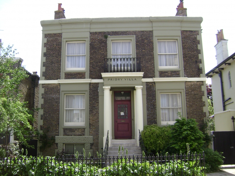
RAMSGATE WEST CLIFF ROAD TR 3764 NE (south side) 12/433 No. 52 (Priory House) GV II House. Circa 1840. Stock brick with rendered details. Two storeys and basement with string course, quoins and parapet to roof with stacks to left and to right. Three sashes on first floor, with moulded surrounds and cornices to outer windows, with the jambs carried down to string course. Central bowed palmate iron balcony. Two sashes on ground floor with flying cornices. Sashes to basement with vermiculated rusticated surrounds. Central half-glazed door with rectangular fanlight in Doric porch at head of 9 steps, with cast iron railings.
Listing NGR: TR3757164517
External links are from the relevant listing authority and, where applicable, Wikidata. Wikidata IDs may be related buildings as well as this specific building. If you want to add or update a link, you will need to do so by editing the Wikidata entry.


Other nearby listed buildings