Latitude: 51.3313 / 51°19'52"N
Longitude: 1.3913 / 1°23'28"E
OS Eastings: 636338
OS Northings: 164593
OS Grid: TR363645
Mapcode National: GBR X0K.JJY
Mapcode Global: VHMCW.2SCT
Plus Code: 9F3389JR+GG
Entry Name: Chilton Farmhouse
Listing Date: 4 February 1988
Grade: II*
Source: Historic England
Source ID: 1085400
English Heritage Legacy ID: 171723
ID on this website: 101085400
Location: Chilton, Thanet, Kent, CT11
County: Kent
District: Thanet
Civil Parish: Ramsgate
Built-Up Area: Ramsgate
Traditional County: Kent
Lieutenancy Area (Ceremonial County): Kent
Tagged with: Farmhouse
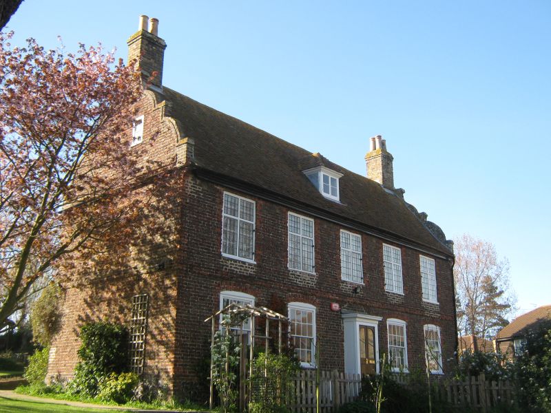
RAMSGATE CHILTON LANE TR 36 SE (west side) 3/94 Chilton Farmhouse II* House. 1713 on C16 foundations. Red brick and coursed flint (especially to right return) with plain tiled roof. Two storeys, basement and attic on flint plinth with plat band and moulded wooden eaves cornice to roof with Dutch gables, stacks to end left and to end right, and central hipped dormer. Regular fenestration of 5 cross windows on first floor, and 4 glazing bar sashes on ground floor with segmental heads. Four segmentally headed basement lights. Central half-glazed door with projecting flat roofed porch. Two storey hipped extension to right. Right return lower wall of coursed C16 flintwork (archaeological evidence indicates continued use as settlement site pre-medieval).
Listing NGR: TR3633864593
External links are from the relevant listing authority and, where applicable, Wikidata. Wikidata IDs may be related buildings as well as this specific building. If you want to add or update a link, you will need to do so by editing the Wikidata entry.


Other nearby listed buildings