Latitude: 51.3271 / 51°19'37"N
Longitude: 1.3916 / 1°23'29"E
OS Eastings: 636379
OS Northings: 164133
OS Grid: TR363641
Mapcode National: GBR X0K.QMH
Mapcode Global: VHMCW.2WJZ
Plus Code: 9F3389GR+VJ
Entry Name: The Belle Vue Tavern and Attached Block
Listing Date: 4 February 1988
Grade: II
Source: Historic England
Source ID: 1085329
English Heritage Legacy ID: 171940
ID on this website: 101085329
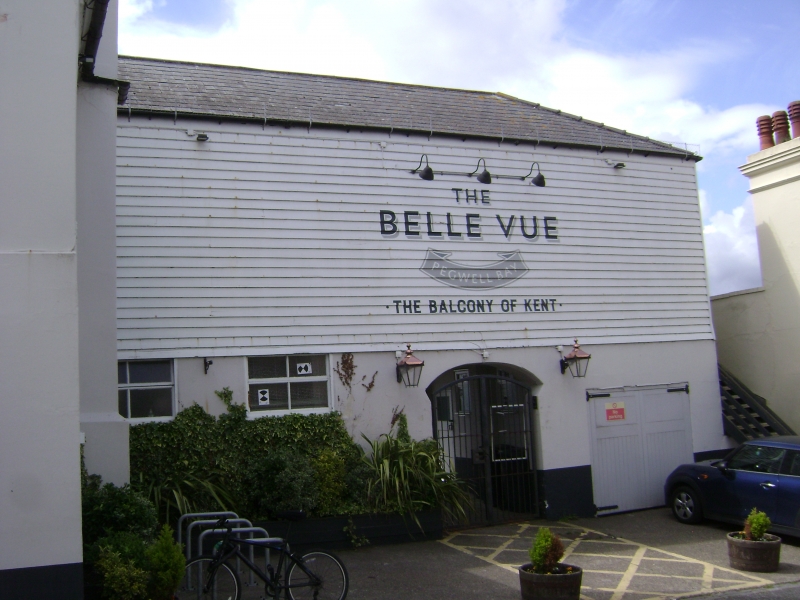
RAMSGATE PEGWELL ROAD TR 3664 SW (south side) 15/306 The Belle Vue Tavern and attached block GV II Public House. Mid C18. Rendered and painted brick with plain tiled roof. Two storeys, attic and basement with plinth, recessed upper storey and half-hipped gambrel roof with 2 flat roofed dormers and stacks to end left and right. Kneelered parapet gabled extension to right. Two sashes to left on 1st floor, of different sizes, and small garret light to right. Sashes to left and to right as main range, with wooden casement and sash with vertical glazing bars to right hand wing. Half-glazed door to centre left and double half-glazed to centre right with cornice on consoles. Basement openings to left and to right. Attached to right a C19 block, rendered with weather boarded upper floor and slate roof. Two storeys with hipped roof with a wooden casements, garage doors to right and central carriage passage . A public house since at least 1760, and unaltered since at least 1790 (print illustrated in Mirams, Old Ramsgate Pubs, 49).
Listing NGR: TR3637964133
External links are from the relevant listing authority and, where applicable, Wikidata. Wikidata IDs may be related buildings as well as this specific building. If you want to add or update a link, you will need to do so by editing the Wikidata entry.


Other nearby listed buildings