Latitude: 51.1411 / 51°8'27"N
Longitude: 1.2837 / 1°17'1"E
OS Eastings: 629794
OS Northings: 143106
OS Grid: TR297431
Mapcode National: GBR W1F.FD2
Mapcode Global: VHLHB.6LJ3
Plus Code: 9F3347RM+CF
Entry Name: The Old Vicarage
Listing Date: 30 June 1949
Grade: II
Source: Historic England
Source ID: 1070317
English Heritage Legacy ID: 177802
ID on this website: 101070317
Location: Crabble, Dover, Kent, CT17
County: Kent
District: Dover
Civil Parish: River
Built-Up Area: Dover
Traditional County: Kent
Lieutenancy Area (Ceremonial County): Kent
Tagged with: Clergy house
LOWER ROAD, CRABBLE 1. (South West Side) 1050 The Old Vicarage TR 2943 5/53 30.6.49.
II GV
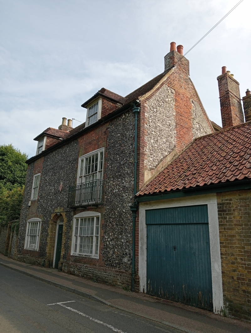
2. Early Cl9. 2 storeys and attics flint with red brick dressings and quoins. Roof has 2 dormers and wooden eaves cornice. 2 sashes with glazing bars intact. Iron balcony to northern 1st floor window. Round-headed doorcase with semi- circular fanlight and 6 panel moulded door. The south front is of 2 storeys yellow brick. 4 windows with iron balcony on the lst floor.
Forms a group with Crabble Court.
Listing NGR: TR2979443106
External links are from the relevant listing authority and, where applicable, Wikidata. Wikidata IDs may be related buildings as well as this specific building. If you want to add or update a link, you will need to do so by editing the Wikidata entry.


Other nearby listed buildings