Latitude: 51.1441 / 51°8'38"N
Longitude: 1.2766 / 1°16'35"E
OS Eastings: 629278
OS Northings: 143418
OS Grid: TR292434
Mapcode National: GBR W1D.CJH
Mapcode Global: VHLHB.2HQS
Plus Code: 9F3347VG+JJ
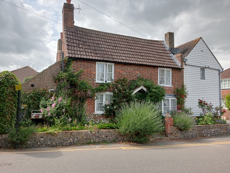
Entry Name: Ivy Cottage
Listing Date: 17 December 1973
Grade: II
Source: Historic England
Source ID: 1069531
English Heritage Legacy ID: 177744
ID on this website: 101069531
Location: River, Dover, Kent, CT17
County: Kent
District: Dover
Civil Parish: River
Built-Up Area: Dover
Traditional County: Kent
Lieutenancy Area (Ceremonial County): Kent
Tagged with: Cottage
COMMON LANE 1. CRABBLE 1050 No 12 (Ivy Cottage) TR 2943 5/60
II
2. Early C19. 2 storeys red brick with some grey headers. Re-roofing with red putty in imitation of pantiles. 2 sashes with glazing bars intact set in moulded wooden architraves. Sun fire plaque. Restored weatherhood and a 6 panelled-moulded door, the top 2 panels cut away and glazed. The rear elevation forms No 66 River Street. Early Cl9. 2 storeys flint-faced with red brink quoins. Tiled roof. 2 sashes with glazing bars intact. Cambered casement on ground floor.
Listing NGR: TR2927843418
External links are from the relevant listing authority and, where applicable, Wikidata. Wikidata IDs may be related buildings as well as this specific building. If you want to add or update a link, you will need to do so by editing the Wikidata entry.


Other nearby listed buildings