Latitude: 51.3368 / 51°20'12"N
Longitude: 1.4136 / 1°24'49"E
OS Eastings: 637865
OS Northings: 165283
OS Grid: TR378652
Mapcode National: GBR X0L.479
Mapcode Global: VHMCW.GN5J
Plus Code: 9F338CP7+PC
Entry Name: 152, High Street
Listing Date: 4 February 1988
Grade: II
Source: Historic England
Source ID: 1068884
English Heritage Legacy ID: 171811
ID on this website: 101068884
Location: Ramsgate, Thanet, Kent, CT11
County: Kent
District: Thanet
Civil Parish: Ramsgate
Built-Up Area: Ramsgate
Traditional County: Kent
Lieutenancy Area (Ceremonial County): Kent
Tagged with: Building
TR 3765 SE
8/182
RAMSGATE
HIGH STREET
(south-west side)
No. 152
GV
II
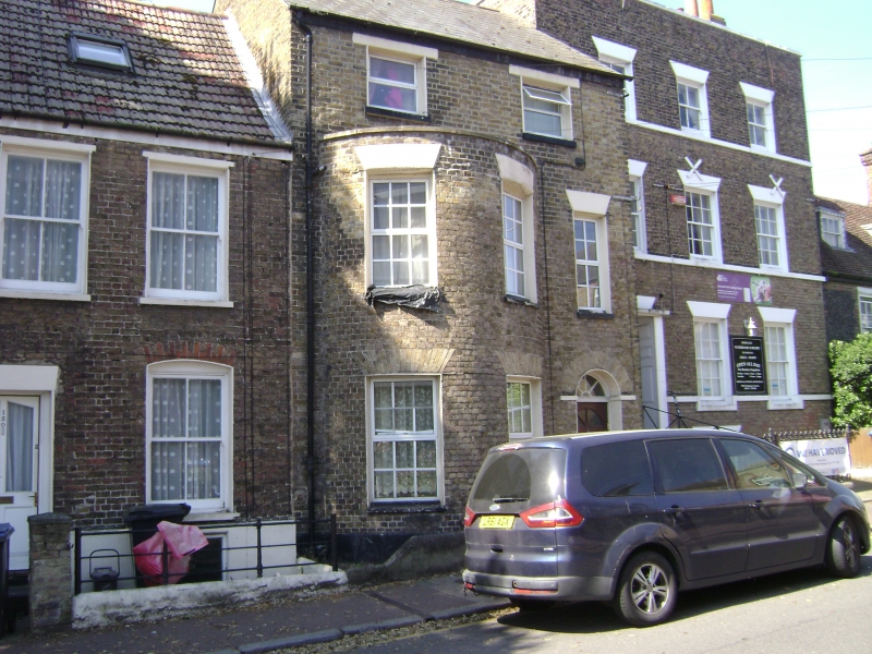
House. Circa 1800. Stock brick and slate roof. Three storeys with
stacks to rear. Two C20 replacement windows on 2nd floor, 1 to right
on 1st floor and 2 storey bow to left with 2 windows to each floor,
with gauged heads ( some painted). Glazed door to right with traceried
semi-circular fanlight in gauged surround shown on Collard and Hurst's
1822 plan of Ramsgate. Included for group value.
Listing NGR: TR3786565283
External links are from the relevant listing authority and, where applicable, Wikidata. Wikidata IDs may be related buildings as well as this specific building. If you want to add or update a link, you will need to do so by editing the Wikidata entry.


Other nearby listed buildings