Latitude: 51.3369 / 51°20'12"N
Longitude: 1.4134 / 1°24'48"E
OS Eastings: 637850
OS Northings: 165288
OS Grid: TR378652
Mapcode National: GBR X0L.452
Mapcode Global: VHMCW.GN2H
Plus Code: 9F338CP7+Q9
Entry Name: The Cottage
Listing Date: 13 August 1968
Grade: II
Source: Historic England
Source ID: 1068876
English Heritage Legacy ID: 171809
ID on this website: 101068876
Location: Ramsgate, Thanet, Kent, CT11
County: Kent
District: Thanet
Civil Parish: Ramsgate
Built-Up Area: Ramsgate
Traditional County: Kent
Lieutenancy Area (Ceremonial County): Kent
Tagged with: Cottage
TR 3765 SE
8/180
13.8.68
RAMSGATE
HIGH STREET
(south-west side)
No. 156 (The Cottage)
GV
II
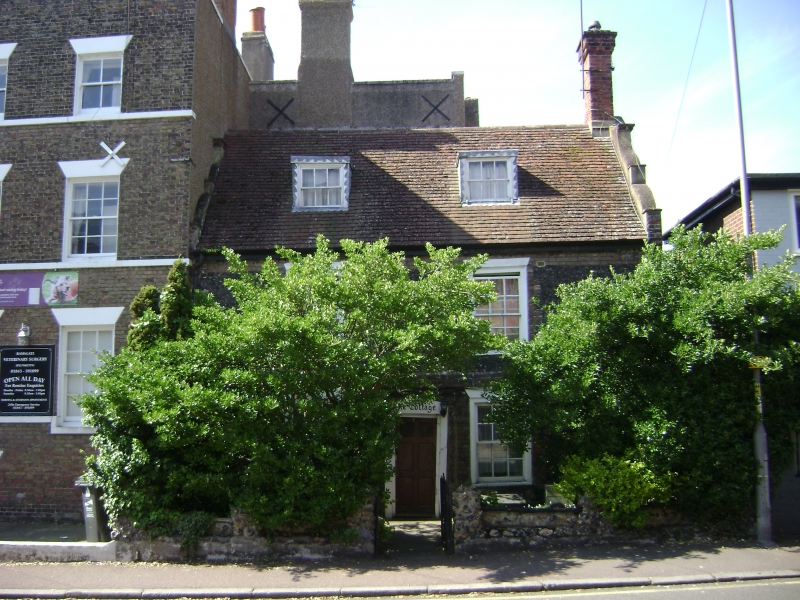
House. Dated 1711. Knapped and coursed flint with red brick dressings
and plain tiled roof. Two storeys and attic on plinth with plat band
with boxed eaves to roof with Dutch shaped gables, 2 flat roofed dormers
and stack to end right. Two glazing bar sashes on each floor with
central half-glazed door in segmental surround. To end left on 1st
floor is half only of a roundel with date plaque, showing only the
final 11 of the date (1711), indicating the house was originally part of
a larger building, possibly that marked Little Ellington on 1735 plan
of Ramsgate. (See Busson, Ramsgate, 70).
Listing NGR: TR3785065288
External links are from the relevant listing authority and, where applicable, Wikidata. Wikidata IDs may be related buildings as well as this specific building. If you want to add or update a link, you will need to do so by editing the Wikidata entry.


Other nearby listed buildings