Latitude: 53.389 / 53°23'20"N
Longitude: -2.9561 / 2°57'21"W
OS Eastings: 336510
OS Northings: 388440
OS Grid: SJ365884
Mapcode National: GBR 7BW.J4
Mapcode Global: WH87F.K2KS
Plus Code: 9C5V92QV+HH
Entry Name: Former Stable Block
Listing Date: 14 March 1975
Last Amended: 19 June 1985
Grade: II
Source: Historic England
Source ID: 1068285
English Heritage Legacy ID: 214011
ID on this website: 101068285
Location: Princes Park, Liverpool, Merseyside, L8
County: Liverpool
Electoral Ward/Division: Princes Park
Parish: Non Civil Parish
Built-Up Area: Liverpool
Traditional County: Lancashire
Lieutenancy Area (Ceremonial County): Merseyside
Church of England Parish: Toxteth St Philemon
Church of England Diocese: Liverpool
Tagged with: Stable
SJ 3688 DEVONSHIRE ROAD (north side) L8
32/373 Former stable block (formerly listed as former stable block opposite No.3) 14.3.75 G.V. II
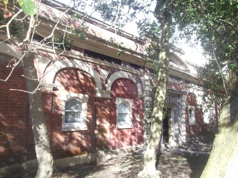
Large square courtyard block of livery stables, now used as garages. 1850s. Brick with stucco dressings, slate roof. 17 bays to Devonshire Road. End and central bays break forward. Entablature with red and blue brick frieze; parapet. Blind arcade with stucco elliptical arches. End and central bays have rusticated quoins, central bay has segmental-headed entrance with rusticated surround and consoled cornice with antefixae, segmental pediment above. Stucco much decayed (1984). Rear to South Street has courtyard with central block and screen walls and gates, much altered, some segmental-headed entrances and stone pitching eyes, 4 pedimented gables to street.
Listing NGR: SJ3651088440
External links are from the relevant listing authority and, where applicable, Wikidata. Wikidata IDs may be related buildings as well as this specific building. If you want to add or update a link, you will need to do so by editing the Wikidata entry.


Other nearby listed buildings