Latitude: 51.2792 / 51°16'45"N
Longitude: 1.2753 / 1°16'30"E
OS Eastings: 628517
OS Northings: 158436
OS Grid: TR285584
Mapcode National: GBR VZN.R7G
Mapcode Global: VHLGR.231P
Plus Code: 9F3377HG+M4
Entry Name: Cape House
Listing Date: 26 November 1987
Grade: II
Source: Historic England
Source ID: 1054909
English Heritage Legacy ID: 178098
ID on this website: 101054909
Location: Ash, Dover, Kent, CT3
County: Kent
District: Dover
Civil Parish: Ash
Built-Up Area: Ash
Traditional County: Kent
Lieutenancy Area (Ceremonial County): Kent
Tagged with: House
ASH THE STREET TR 2858 (north side) 10/68 Cape House GV II
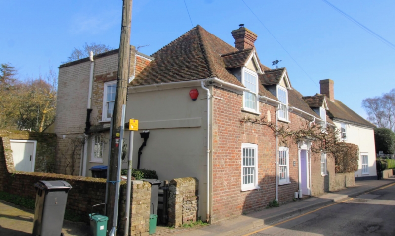
House. Dated 1724. Red brick and plain tiled roof. Lobby entry plan. One storey and attic with hipped roof, 3 gabled semi-dormers and stack to centre right. Three glazing bar sashes with cambered heads and door to centre right of 6 panels in panelled surround with fluted pilasters and flat hood on consoles. Date plaque in semi-circular recess to top left, ornately inscribed : R E A 1724 Left return: with channelled render, plat band and quoins. Parallel wing with tile hanging to rear.
Listing NGR: TR2851758434
External links are from the relevant listing authority and, where applicable, Wikidata. Wikidata IDs may be related buildings as well as this specific building. If you want to add or update a link, you will need to do so by editing the Wikidata entry.


Other nearby listed buildings