Latitude: 53.31 / 53°18'35"N
Longitude: -1.3558 / 1°21'21"W
OS Eastings: 443017
OS Northings: 379420
OS Grid: SK430794
Mapcode National: GBR LZZ5.85
Mapcode Global: WHDF4.42MB
Plus Code: 9C5W8J5V+XM
Entry Name: Numbers 24-28 (Even) Including Premises Occupied by Scarlett Ribbons, New Wizard and Woodheads
Listing Date: 7 July 1989
Grade: II
Source: Historic England
Source ID: 1054885
English Heritage Legacy ID: 79579
ID on this website: 101054885
Location: Eckington, North East Derbyshire, S21
County: Derbyshire
District: North East Derbyshire
Civil Parish: Eckington
Built-Up Area: Eckington
Traditional County: Derbyshire
Lieutenancy Area (Ceremonial County): Derbyshire
Church of England Parish: Eckington and Ridgeway
Church of England Diocese: Derby
Tagged with: Building
PARISH OF ECKINGTON MARKET STREET SK 4379 (North-West Side) 11/100 Nos 24-28 Market Street (even) including premises occupied by Scarlett Ribbons, New Wizard and Woodheads II
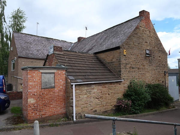
Terrace of shops, incorporating a dwelling to the rear. c1500, substantially remodelled post 1700, and with subsequent alterations and additions in C19 and C20. Coursed coal measures sandstone, encasing the substantial remains of a close studded timber frame, the exterior stonework now largely concealed by roughcast and smooth render. Originally a T-plan house, now with a gabled addition to the rear, and flat roofed single storey shop units added at the front. C19 casement windows and some C20 frames to the first floor of street elevation. The timber frame survives at first floor level, although the corner posts may remain full height in some areas. Four bay main range with close studded partition walls into the attic floor. The north-east gable survives and is partially exposed in the attached property at first floor level and contains a close studded truss with corner posts having massive jowelled heads and arch braced tie beam, with a collar above. The truss supports a double purlin roof and there are substantial windbraces within the attic. To the rear of the property, within the angle of two ranges at the north-east end, is a square stone tower, partially rendered, with capped at eaves level. This may have been an external stack. The single storey shop units to the street frontage are not of special interest.
Listing NGR: SK4301779420
External links are from the relevant listing authority and, where applicable, Wikidata. Wikidata IDs may be related buildings as well as this specific building. If you want to add or update a link, you will need to do so by editing the Wikidata entry.


Other nearby listed buildings