Latitude: 51.3386 / 51°20'19"N
Longitude: 1.4122 / 1°24'43"E
OS Eastings: 637757
OS Northings: 165476
OS Grid: TR377654
Mapcode National: GBR X0L.3VD
Mapcode Global: VHMCW.FMF5
Plus Code: 9F338CQ6+CV
Entry Name: 5, Park Road
Listing Date: 13 August 1968
Grade: II
Source: Historic England
Source ID: 1054787
English Heritage Legacy ID: 171930
ID on this website: 101054787
Location: Ramsgate, Thanet, Kent, CT11
County: Kent
District: Thanet
Civil Parish: Ramsgate
Built-Up Area: Ramsgate
Traditional County: Kent
Lieutenancy Area (Ceremonial County): Kent
Tagged with: Building
TR 3765 SE
8/297
13.8.68
RAMSGATE
PARK ROAD
(north side)
No. 5
GV
II
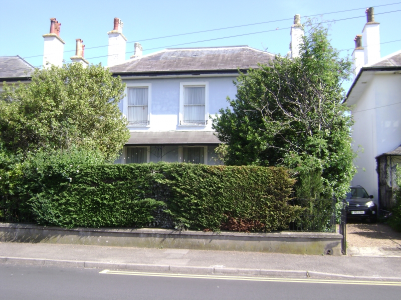
House. Early C19. Rendered with slate roof. Two storeys and basement
with hipped roof and stacks to left and to right. Three sashes in
moulded surrounds on 1st floor, and 3 three-leaved sashes on ground floor
in moulded surrounds with tented verandah with scallop-pattern iron
brackets to piers. Steps to central window. Two glazing bar sashes to
basement. Entry in recessed doorway on right return. One of 3 identical
villas here.
Listing NGR: TR3775765476
External links are from the relevant listing authority and, where applicable, Wikidata. Wikidata IDs may be related buildings as well as this specific building. If you want to add or update a link, you will need to do so by editing the Wikidata entry.


Other nearby listed buildings