Latitude: 51.5838 / 51°35'1"N
Longitude: -1.6484 / 1°38'54"W
OS Eastings: 424454
OS Northings: 187270
OS Grid: SU244872
Mapcode National: GBR 5WK.Q1H
Mapcode Global: VHC0Y.CGW7
Plus Code: 9C3WH9M2+GJ
Entry Name: Stainswick Farmhouse
Listing Date: 31 October 1983
Grade: II
Source: Historic England
Source ID: 1048757
English Heritage Legacy ID: 250612
ID on this website: 101048757
Location: Vale of White Horse, Oxfordshire, SN6
County: Oxfordshire
District: Vale of White Horse
Civil Parish: Shrivenham
Traditional County: Berkshire
Lieutenancy Area (Ceremonial County): Oxfordshire
Church of England Parish: Shrivenham with Watchfield and Bourton
Church of England Diocese: Oxford
Tagged with: Farmhouse
1. SHRIVENHAM STAINSWICK LANE (west side) SU 28 NW 4/64 Stainswick Farmhouse
II
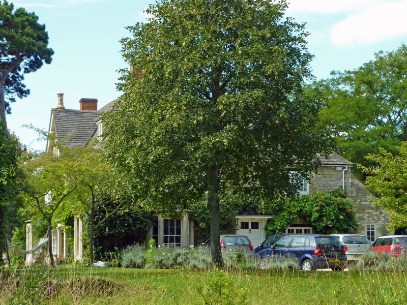
2. C17 with early C18 additions, extensively altered in the C19 of rubble stone and some roughcast, dressed stone quoins and a Bradstone tiled gabled at the E, half hipped at the W with end brick stacks on the C17 range and original stone tiled roofs to the later additions. The C17 range with a principal S front was extended to the E and to the rear to form an irregular rectangular plan. 2 storeys and attic. S front comprises a 3 window range of the original C17 front and a 2 bay range to the E of the C18. The 3rd bay of the original front has a C19 gable to the upper storey and both the C17 and C18 sections have a C19 polygonal bay window on the ground floor. The remaining windows are c20 casements apart from 2 hipped dormers in the roof. Late C19 stone porch to panelled door in the 4th bay from the left. The E wall has 2 porthole windows above a C20 conservatory. A small bread oven projects from a NE wall to the rear, it is of rubble stone with a stone tiled roof. The farmhouse is built on an elevated circular site surrounded by a ha-ha.
Listing NGR: SU2445487270
External links are from the relevant listing authority and, where applicable, Wikidata. Wikidata IDs may be related buildings as well as this specific building. If you want to add or update a link, you will need to do so by editing the Wikidata entry.


Other nearby listed buildings