Latitude: 55.0434 / 55°2'36"N
Longitude: -1.8779 / 1°52'40"W
OS Eastings: 407901
OS Northings: 572103
OS Grid: NZ079721
Mapcode National: GBR HBB3.7W
Mapcode Global: WHC37.4H1J
Plus Code: 9C7W24VC+9R
Entry Name: The Old Manse
Listing Date: 28 April 1969
Grade: II
Source: Historic England
Source ID: 1042664
English Heritage Legacy ID: 238877
ID on this website: 101042664
Location: Stamfordham, Northumberland, NE18
County: Northumberland
Civil Parish: Stamfordham
Built-Up Area: Stamfordham
Traditional County: Northumberland
Lieutenancy Area (Ceremonial County): Northumberland
Church of England Parish: Stamfordham
Church of England Diocese: Newcastle
Tagged with: Building
STAMFORDHAM THE GREEN NZ 0772 (North side)
28/391 No. 3 (The Old Manse) 28.4.69
GV II
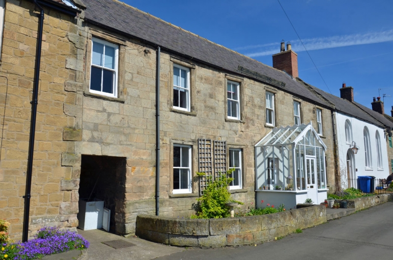
House, formerly the presbyterian manse. Early C18 (possibly dated 1715, but datestone worn). Dressed stone with Welsh slate roof. 2 storeys, 5 and 1 bays. High plinth to ground-floor sill level. Rusticated quoins. Left bay has through-passage, lintel with dated keystone. Main 5-bay house has central doorway with 2-leaf panelled door in open-pedimented stone surround with scrolled brackets and thin pilasters. Late C19 glazed porch. 4-pane sashes in architraves with moulded sills. Steeply-pitched gabled roof with flat coping and old brick end stacks.
Interior has several 2-panel doors and panelled shutters. Two early C18 stone fireplaces on 1st floor with moulded edges and lobed lintels.
Listing NGR: NZ0790172103
External links are from the relevant listing authority and, where applicable, Wikidata. Wikidata IDs may be related buildings as well as this specific building. If you want to add or update a link, you will need to do so by editing the Wikidata entry.


Other nearby listed buildings