Latitude: 51.1462 / 51°8'46"N
Longitude: -1.7159 / 1°42'57"W
OS Eastings: 419972
OS Northings: 138586
OS Grid: SU199385
Mapcode National: GBR 50K.50D
Mapcode Global: VHC31.6GR5
Plus Code: 9C3W47WM+FM
Entry Name: Queen Manor
Listing Date: 29 May 1987
Grade: II
Source: Historic England
Source ID: 1023976
English Heritage Legacy ID: 319904
ID on this website: 101023976
Location: Boscombe, Wiltshire, SP4
County: Wiltshire
Civil Parish: Allington
Traditional County: Wiltshire
Lieutenancy Area (Ceremonial County): Wiltshire
Church of England Parish: Allington with Boscombe St John the Baptist
Church of England Diocese: Salisbury
Tagged with: Manor house
ALLINGTON BOSCOMBE SU 13 NE (north-west side) 3/6 Queen Manor II
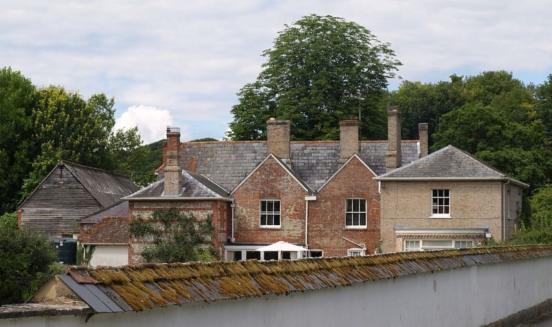
Farmhouse. c.1700 and after 1835. Colourwashed brick with slate roof. Two storeys. North block of 4 bays with cross passage flanked by heated rooms, with mid C18 bay added on right, and rear wings at both ends built c.1835 with linking block covering rear of earlier build. This work probably by Robert Waters. Entrance within portico on square piers. Plat band. C19 casement windows but 12-pane sashes in added bay. South west wing of flint with brick banding. Roof half-hipped to west and fully hipped on later bay and to rear wings. Central section has two rear gables. Interior has various fielded panelled doors reset. C19 wing has pine fireplace and coved cornice and a dentilled frieze on upper floor. Roof of early section has 2 tiers of butt purlins and cambered collar and tie beam trusses. (RCHM survey. January 1978).
Listing NGR: SU1997238586
External links are from the relevant listing authority and, where applicable, Wikidata. Wikidata IDs may be related buildings as well as this specific building. If you want to add or update a link, you will need to do so by editing the Wikidata entry.


Other nearby listed buildings