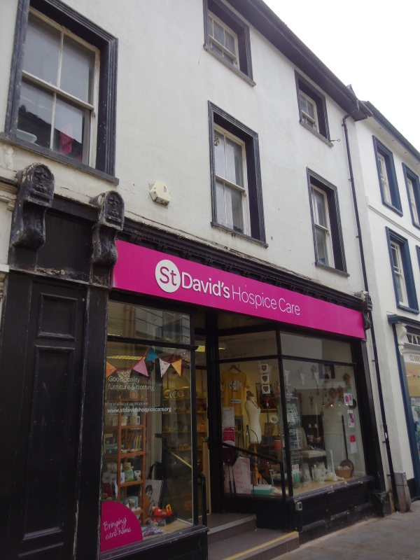
16, High Street Inferior
A Grade II Listed Building in Brecon, Powys
Coordinates
Latitude: 51.9478 / 51°56'52"N
Longitude: -3.3912 / 3°23'28"W
OS Eastings: 304477
OS Northings: 228617
OS Grid: SO044286
Mapcode National: GBR YP.MFFK
Mapcode Global: VH6BZ.59KN
Plus Code: 9C3RWJX5+4G
Entry Name: 16, High Street Inferior
Listing Date: 16 December 1976
Grade: II
Source: Cadw
Source ID: 85624
ID on this website: 300085624
Location: Where High Street narrows, opposite free-standing block. Shown as Nos 16 and 17 on OS map but bear numbers as Nos 14 to 17 (consec).
County: Powys
Town: Brecon
Community: Brecon (Aberhonddu)
Community: Brecon
Built-Up Area: Brecon
Traditional County: Brecknockshire
Tagged with:
Building
History
Mid-to-late C19.
Reasons for Listing
Mid C19 buildings retaining typical character on important site in historic centre of Brecon. Group Value with adjacent listed buildings.
External Links
External links are from the relevant listing authority and, where applicable, Wikidata.
Wikidata IDs may be related buildings as well as this specific building. If you want to add or update a link, you
will need to do so by editing the Wikidata entry.
Recommended Books
Other nearby listed buildings
-
II
Warwick House
Where High Street narrows, opposite free-standing block. Shown as Nos 16 and 17 on OS map but bear numbers as Nos 14 to 17 (consec).
-
II
17, High Street Inferior
Where High Street narrows, opposite free-standing block. Shown as Nos 16 and 17 on OS map but bear numbers as Nos 14 to 17 (consec).
-
II
NO.13 High Street Inferior, Powys
About 40 metres NW of town hall, where street line bends. Shown on OS map as No 15 but known to local authority as No 13.
-
II
NO.40 High Street Inferior (Island Site), Powys
Part of the island block in High Street. Entrance front faces north. Shown as No 36 on OS map but known to council and to the occupiers as No 40.
-
II
NO.41 High Street Inferior (Island Site), Powys
Part of the island block in the High Street. Immediately to N of Lloyd's Bank. Marked erroneously on OS Map as No 38A.
-
II
NO.39 High Street Inferior (Island Site), Powys
On island site in the High Street, with fronts to W and E.
-
II
NO.18 High Street Inferior, Powys
Facing the triangular space N of the free-standing block in High Street.
-
II
Lloyd's TSB
Makes up S end of island block in High Street.