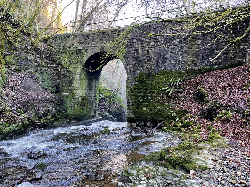
Devil’s Bridge
A Grade II Listed Building in Llanelly, Monmouthshire
Coordinates
Latitude: 51.8055 / 51°48'19"N
Longitude: -3.1394 / 3°8'21"W
OS Eastings: 321539
OS Northings: 212486
OS Grid: SO215124
Mapcode National: GBR F0.XHWQ
Mapcode Global: VH6CP.JWQ9
Plus Code: 9C3RRV46+57
Entry Name: Devil’s Bridge
Listing Date: 27 July 2000
Grade: II
Source: Cadw
Source ID: 23825
Building Class: Transport
ID on this website: 300023825
Location: Located some 250m N of Gellyfelen, carrying public footpath over steep ravine of Clydach river.
County: Monmouthshire
Community: Llanelly (Llanelli)
Community: Llanelly
Locality: Gellifelen
Traditional County: Brecknockshire
Tagged with:
Bridge
Footbridge
History
Pack-horse bridge late C17 or early C18, probably built to convey minerals to Llanelly Furnace, which was in operation by 1684. The bridge remains in good condition, despite being superseded by the several late C18 and early C19 tramroads in the Clydach Gorge, and forms part of the walks within the Clydach Gorge nature reserve.
Exterior
Rubble built single-arch bridge with very low cemented parapet; C20 metal railings. Tall round-headed arch with cut stone voussoirs.
Reasons for Listing
Listed as a well-preserved late C17 or early C18 pack-horse bridge, associated with the local ironworks. The bridge is a prominent and early survival of the important industrial landscape of the Clydach Gorge.
External Links
External links are from the relevant listing authority and, where applicable, Wikidata.
Wikidata IDs may be related buildings as well as this specific building. If you want to add or update a link, you
will need to do so by editing the Wikidata entry.
Recommended Books
Other nearby listed buildings
-
II
Revetment of former Merthyr, Tredegar and Abergavenny Railway at Darrenfelen
Located W of Darrenfelen on steep side of the Clydach Gorge, below Darrenfelen - Clydach by-road. Prominently visible from Heads of the Valleys Road (A465).
-
II
Limekilns at Blackrock Limeworks, including Loading-ramp
Prominently located alongside lay-by on the N side of the main road between the settlements of Blackrock and Cheltenham.
-
II
Milestone at Pont-gam
Situated on S side of by-road between Brynmawr and Blackrock. Approximately 2 km W of Blackrock.
-
II
Gellifelen Tramroad Bridge
Bridges carries public road between Darrenfelen and Gellifelen over very sharp bend above steep river ravine. Approximately 1 km S of Darrenfelen.
-
II
Limekilns at Llanelly Limeworks
Former quarry located approximately 1 km NE of Darrenfelen, alongside by-road between Clydach and Darrenfelen. Quarry is entered via tunnels underneath small railway viaduct, and kiln is located on th
-
II
Tramroad Bridge over Sychnant River
Bridge carries public footpath over river Sychnant, which follows line of tramroad incline between Dan-y-coed and the former quarries at Darrenfelen. Approximately 2 km SW of Clydach.
-
II
Three Arch Viaduct of former Merthyr, Tredegar and Abergavenny Railway
Located some 0.5km SW of Clydach village, over steep gorge off SE side of Darrenfelen-Clydach by-road.
-
II
Clydach Wesleyan Chapel including Sunday School and railed forecourt
Located in centre of small roadside village, on S side of road, above A465 (Heads of the Valleys Road).