Milestone
A Grade II Listed Building in Penygroes, Gwynedd
Coordinates
Latitude: 53.0586 / 53°3'30"N
Longitude: -4.2813 / 4°16'52"W
OS Eastings: 247210
OS Northings: 353691
OS Grid: SH472536
Mapcode National: GBR 5H.CBH1
Mapcode Global: WH43T.6DJ2
Plus Code: 9C5Q3P59+CF
Entry Name: Milestone
Listing Date: 21 July 2000
Grade: II
Source: Cadw
Source ID: 23696
Building Class: Transport
ID on this website: 300023696
Location: Located on the east side of the A 487 on the northern edge of Penygroes; set in a rubblestone boundary wall.
County: Gwynedd
Community: Llanllyfni
Community: Llanllyfni
Locality: Penygroes
Built-Up Area: Penygroes
Traditional County: Caernarfonshire
Tagged with:
Milestone
History
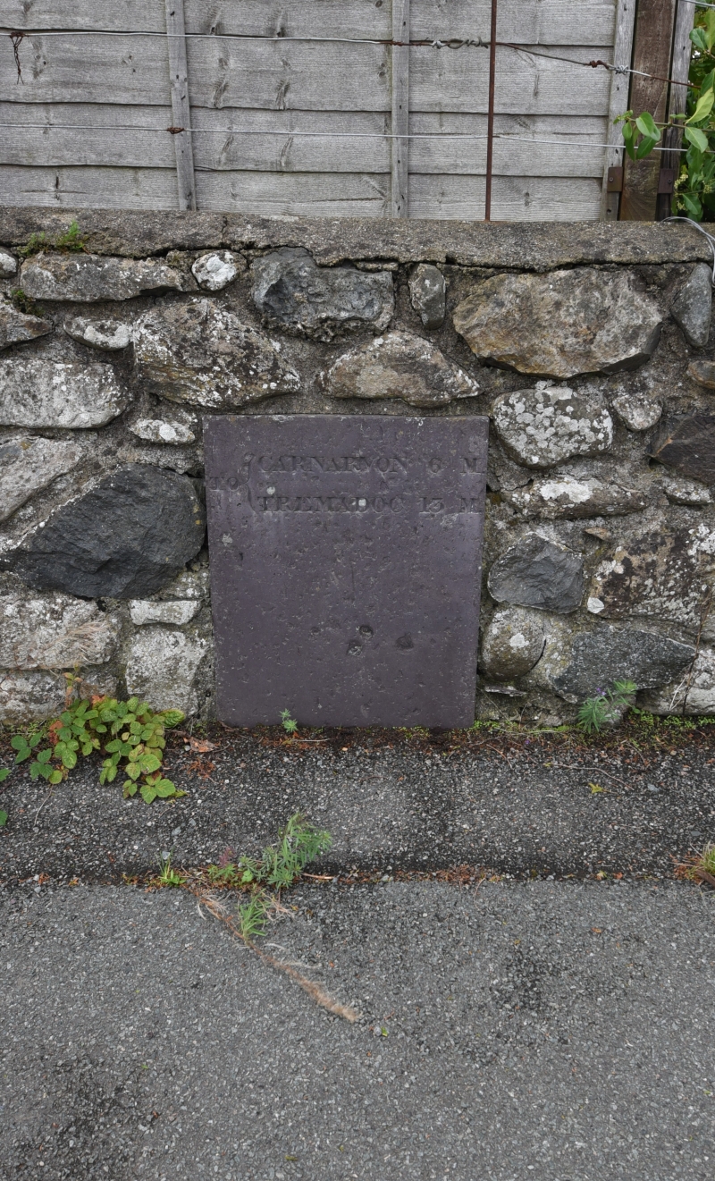
The very plain and simple form of the milestone and the style of its lettering suggest that it may be slightly earlier than the others on the same road to the south. The turnpike road was first established in the 1820s.
Exterior
Plain rectangular slate-stone set in boundary wall. Inscribed "TO CARNARVON 6 ML/ TREMADOC 13 ML".
Reasons for Listing
Included for its special historic interest as a turnpike road milestone, one of the first to be erected on this stretch of road.
External Links
External links are from the relevant listing authority and, where applicable, Wikidata.
Wikidata IDs may be related buildings as well as this specific building. If you want to add or update a link, you
will need to do so by editing the Wikidata entry.
Recommended Books
Other nearby listed buildings
-
II
Sunday School/vestry to Bethel Chapel, including railings and gates
Prominently sited on slightly rising ground, into which it is set, its chapel on the other side of the road, the Sunday School is located towards the northern end of Penygroes.
-
II
Bethel Chapel, railed enclosure and gates
Prominently situated on slightly rising ground, into which it is set, towards the northern end of Penygroes, its Sunday School on the other side of the road, the chapel sits in its own walled and rail
-
II
Hen-dy
Located on the west side of Ffordd Haearn Bach (the old tram road) approximately 200m north-west of Pen-y-Groes.
-
II
Muriau & Muriau Stores
Located in the centre of Penygroes on the west side of Heol-y-Dwr (Water Street) near the junction with Lon Pitar.
-
II
Bod Owen
Situated in a prominent position at the junction of Ffordd-y-Sir and Heol Buddog with gardens in front and the similarly detailed Arvon alongside, the highly decorated slate roof of the building forms
-
II
Disused cottage to south-west of Llwyndu Canol
Situated in a lowland position in pasture fields to the north of Ffordd Llwyndu (Llwyndu Road), a minor road running from Penygroes to Carmel.
-
II
Arvon and adjoining outbuildings to the north
Situated in a prominent position at the junction of Heol Buddog and Ffordd-y-Sir with gardens in front and the similarly detailed Bod Owen alongside, the highly patterned slate roofs of Arvon and its
-
II
Barn at disused cottage to south-west of Llwyndu Canol
Situated immediately to the north-east of the disused cottage to the south-west of Llwyndu Canol.