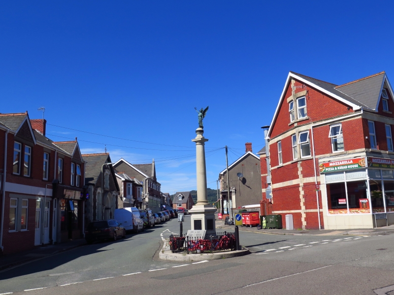
Kenfig Hill War Memorial
A Grade II Listed Building in Pyle, Bridgend
Coordinates
Latitude: 51.5332 / 51°31'59"N
Longitude: -3.678 / 3°40'40"W
OS Eastings: 283707
OS Northings: 182927
OS Grid: SS837829
Mapcode National: GBR H8.GMKT
Mapcode Global: VH5H9.6QGH
Plus Code: 9C3RG8MC+7R
Entry Name: Kenfig Hill War Memorial
Listing Date: 2 January 1998
Grade: II
Source: Cadw
Source ID: 19176
Building Class: Commemorative
ID on this website: 300019176
Location: The memorial stands as a traffic island at the junction of Princes Road and Commercial Road, known as 'top cross', at the centre of Kenfig Hill.
County: Bridgend
Town: Cynffig
Community: Pyle (Y Pîl)
Community: Pyle
Locality: Kenfig Hill
Built-Up Area: Pyle
Traditional County: Glamorgan
Tagged with:
War memorial
History
Erected in 1925 to commemorate the dead of two world wars.
Exterior
Constructed with pale grey fine-grained granite. A Tuscan column raised on a panelled die and base, carrying a stilted ball finial surmounted by a bronze figure of a winged victory, her hand upraised with a wreath, the other holding a baton. Bronze panels applied on each of the four sides of the die are inscribed with the names of the 36 dead of the community fallen in the Great War. A mottled granite monument in the form of an open book has been added on the W side of the base, displaying the names of a further 36 men lost in 1939-45.
Reasons for Listing
Included as a handsomely proportioned and finely executed monument.
External Links
External links are from the relevant listing authority and, where applicable, Wikidata.
Wikidata IDs may be related buildings as well as this specific building. If you want to add or update a link, you
will need to do so by editing the Wikidata entry.
Recommended Books
Other nearby listed buildings
-
II
The Talbot Institute
The building is set in a terrace of C19 buildings, approximately 100m from the junction of Princes Road with Commercial Road.
-
II
Accommodation Bridge over the former Duffryn Llynvi and Porthcawl Railway
The bridge now spans the walk formed along the track of the railway on the W side of the Woodlands Park estate, carrying a farm track. It lies approximately 100m S of the S corner of the estate.
-
II
Mile marker on A48, Pyle to Margam Road
Set at the back of the pavement, 160m S of the railway overbridge.
-
II
Two chest tombs set against the E churchyard wall, Church of St James.
The two tombs are set in a row immediately within the entrance gate and on the S side of the path to the S porch. The character of the churchyard is notable for its tombs.
-
II
Rees Williams monument in the churchyard, St James church.
The monument is set besides the path, approximately half way between the entrance gate to the churchyard, and the S porch. The character of the churchyard is notable for its tombs.
-
II
Group of 4 chest tomb in churchyard of St James, Pyle
The church of St James stands at the N end of Pyle. The group is set against the entrance path from the road to the S porch, approximately 6m S of the nave. The character of the churchyard is notable
-
I
Church of St James, Pyle with Kenfig
The parish church of St James, Pyle, stands in its own churchyard N of the village centre, on the road to Margam.
-
II
Churchyard Cross in St James' churchyard, Pyle
The church of St James is at the N end of the village of Pyle. The churchyard cross is set approximately 9m S of the S porch.