Latitude: 57.0849 / 57°5'5"N
Longitude: -2.2372 / 2°14'14"W
OS Eastings: 385719
OS Northings: 799344
OS Grid: NO857993
Mapcode National: GBR XH.KQJ6
Mapcode Global: WH9R1.L5VZ
Plus Code: 9C9V3QM7+X4
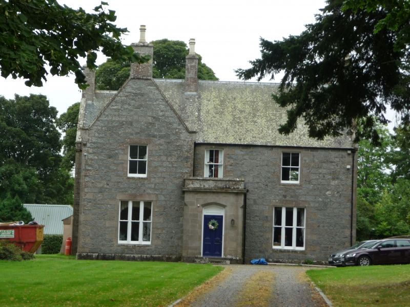
Entry Name: Glenburnie, former manse, Maryculter
Listing Name: Parish Kirk Manse
Listing Date: 25 November 1980
Category: C
Source: Historic Scotland
Source ID: 350217
Historic Scotland Designation Reference: LB16487
Building Class: Cultural
ID on this website: 200350217
Location: Maryculter
County: Aberdeenshire
Electoral Ward: North Kincardine
Parish: Maryculter
Traditional County: Kincardineshire
Tagged with: Manse
Small two-storey, harl and slate 1763. Early and late 19th century, additions.
External links are from the relevant listing authority and, where applicable, Wikidata. Wikidata IDs may be related buildings as well as this specific building. If you want to add or update a link, you will need to do so by editing the Wikidata entry.


Other nearby listed buildings