Latitude: 53.2896 / 53°17'22"N
Longitude: -3.0736 / 3°4'24"W
OS Eastings: 328530
OS Northings: 377495
OS Grid: SJ285774
Mapcode National: GBR 6ZZD.CH
Mapcode Global: WH76M.RKLZ
Plus Code: 9C5R7WQG+RH
Entry Name: Moor End
Listing Date: 22 March 1974
Grade: II
Source: Historic England
Source ID: 1387690
English Heritage Legacy ID: 475676
ID on this website: 101387690
Location: Moorside, Cheshire West and Chester, Cheshire, CH64
County: Cheshire West and Chester
Civil Parish: Neston
Built-Up Area: Neston
Traditional County: Cheshire
Lieutenancy Area (Ceremonial County): Cheshire
Church of England Parish: Neston St Mary and St Helen
Church of England Diocese: Chester
Tagged with: Architectural structure
NESTON
SJ2877 MOORSIDE LANE, Neston Town 794-1/5/73 (South side) 22/03/74 Moor End
II
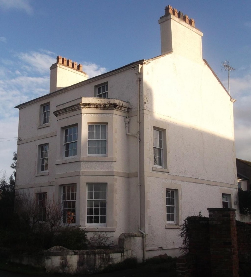
Farmhouse, now private house. Late C18 with later alteration and extension. Roughcast brick on stone plinth, with stucco bands, quoins and dressings; slate roof with lead ridge and guttering; gable end brick stacks. EXTERIOR: 3-storey, 2-bay front with 2-storey canted bay window at right. Entrance in right gable. Windows in main front are recessed sashes with glazing bars and stone sills and lintels. In centre of ground floor is semicircular headed sash window. Projecting first and second floor bands returned across both gable ends. In centre of second floor is a sunken tablet with shell and flower motif. Ogee moulded stone eaves cornice. Right gable end: C20 5-panel door with integral fanlight. INTERIOR: 6-panel and boarded doors; closed string staircase with turned balusters and square newels.
Listing NGR: SJ2853077495
External links are from the relevant listing authority and, where applicable, Wikidata. Wikidata IDs may be related buildings as well as this specific building. If you want to add or update a link, you will need to do so by editing the Wikidata entry.


Other nearby listed buildings