Latitude: 51.8913 / 51°53'28"N
Longitude: -2.0824 / 2°4'56"W
OS Eastings: 394426
OS Northings: 221423
OS Grid: SO944214
Mapcode National: GBR 2MB.8BY
Mapcode Global: VH947.VQHG
Plus Code: 9C3VVWR9+G2
Entry Name: Numbers 5 to 11 and 15 to 19 and Atttached Railings to Numbers 5 and 9
Listing Date: 12 March 1955
Last Amended: 26 November 1998
Grade: II
Source: Historic England
Source ID: 1387396
English Heritage Legacy ID: 475352
ID on this website: 101387396
Location: Montpellier, Cheltenham, Gloucestershire, GL50
County: Gloucestershire
District: Cheltenham
Electoral Ward/Division: Park
Parish: Non Civil Parish
Built-Up Area: Cheltenham
Traditional County: Gloucestershire
Lieutenancy Area (Ceremonial County): Gloucestershire
Church of England Parish: Leckhampton St Philip and St James
Church of England Diocese: Gloucester
Tagged with: Building
CHELTENHAM
SO9421SW PAINSWICK ROAD 630-1/22/609 (West side) 12/03/55 Nos.5-11 AND 15-19 (Odd) and attached railings to Nos.5 and 9 (Formerly Listed as: PAINSWICK ROAD (West side) Nos.5-19 (Odd))
II
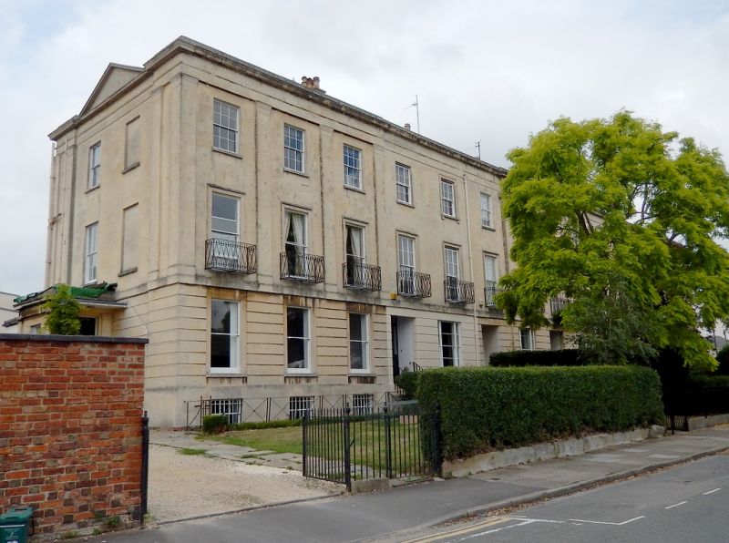
Terrace of 7 houses with attached railings to Nos 5 and 9 (no No.13). c1835. Ashlar over brick with concealed roof and wrought- and iron window-guards and railings. EXTERIOR: 3 storeys on basement, 18 first-floor windows, 3 per house. Off-centre right 5-window breakforward. Ashlar detailing includes horizontal rustication to ground floor, first-floor band surmounted to end 3-window ranges by Doric pilasters (to ends and between windows) and Ionic pilaster to breakforward (to ends and between windows), continuous architrave, frieze, cornice and blocking course. Mainly 6/6 sashes where original, those to first floor are taller and in tooled architraves; ground floor windows (except to 2 outer houses) have tripartite windows with 6/6 or 2/2 between 2/2 sashes where original. Basements have some 3/3 sashes. Entrances: flights of steps (roll-edged where original) to mainly 4-panel doors with sidelights and overlights, those to ends are set back in solid single-storey porches with Doric pilasters, frieze, cornice and low parapet with central panel; otherwise left and centre entrances. Returns have end pilasters and central slight recess with pediment. INTERIOR: not inspected. SUBSIDIARY FEATURES: first-floor window guards have lattice motif. Ground-floor window box to No.11 has scroll motif. Area railings to left have X-motif. Railings to sides of steps to No.9 have embellished rods. HISTORICAL NOTE: Painswick Road was laid out by Charles Baker to connect Cheltenham with Painswick, following and Act of 1820. (Chatwin A: Cheltenham's Ornamental Ironwork: Cheltenham: 1975-1984: 35; Gloucestershire Society for Industrial Archaeology Journal: Garrett JV: Charles Baker of Painswick and Cheltenham: 1989-).
Listing NGR: SO9441921406
External links are from the relevant listing authority and, where applicable, Wikidata. Wikidata IDs may be related buildings as well as this specific building. If you want to add or update a link, you will need to do so by editing the Wikidata entry.


Other nearby listed buildings