Latitude: 52.1101 / 52°6'36"N
Longitude: -2.0751 / 2°4'30"W
OS Eastings: 394956
OS Northings: 245752
OS Grid: SO949457
Mapcode National: GBR 2JM.Q60
Mapcode Global: VH938.Z7C8
Plus Code: 9C4V4W6F+2X
Entry Name: 4, High Street
Listing Date: 11 February 1965
Grade: II
Source: Historic England
Source ID: 1387055
English Heritage Legacy ID: 474471
ID on this website: 101387055
Location: Pershore, Wychavon, Worcestershire, WR10
County: Worcestershire
District: Wychavon
Civil Parish: Pershore
Built-Up Area: Pershore
Traditional County: Worcestershire
Lieutenancy Area (Ceremonial County): Worcestershire
Church of England Parish: Pershore
Church of England Diocese: Worcester
Tagged with: Building
PERSHORE
SO9445 HIGH STREET 648-1/5/112 (West side) 11/02/65 No.4
GV II
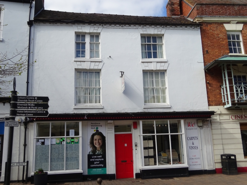
House and shop. Early C19 with later alterations. Brick with stucco render. Plain tile roof with dentilled eaves and brick stack to right end. EXTERIOR: 3 storeys. 2-window range, on 1st floor of 8/8 sashes, on 2nd floor of one 4/8 sash on right and a 2-light window with 2/4 sashes on left, all having channelled voussoirs, keystones, and projecting sills. Ground floor: deep, enriched, cornice supported by shallow pilasters and 2 consoles to right and centre; shopfront has 2 plate-glazed 10-pane bay-windows with thick moulded glazing bars and moulded riser panels; central doorcase with panelled reveal, overlight and 4-panel door. Moulded plinth. INTERIOR: not inspected. HISTORICAL NOTE: former wig maker's premises.
Listing NGR: SO9495645752
External links are from the relevant listing authority and, where applicable, Wikidata. Wikidata IDs may be related buildings as well as this specific building. If you want to add or update a link, you will need to do so by editing the Wikidata entry.


Other nearby listed buildings