Latitude: 50.7905 / 50°47'25"N
Longitude: -1.1088 / 1°6'31"W
OS Eastings: 462911
OS Northings: 99373
OS Grid: SZ629993
Mapcode National: GBR VN6.JX
Mapcode Global: FRA 87K0.3V1
Plus Code: 9C2WQVRR+6F
Entry Name: The Round Tower
Listing Date: 30 October 1969
Last Amended: 18 March 1999
Grade: I
Source: Historic England
Source ID: 1386901
English Heritage Legacy ID: 474314
ID on this website: 101386901
Location: Old Portsmouth, Portsmouth, Hampshire, PO1
County: City of Portsmouth
Electoral Ward/Division: St Thomas
Parish: Non Civil Parish
Built-Up Area: Portsmouth
Traditional County: Hampshire
Lieutenancy Area (Ceremonial County): Hampshire
Church of England Parish: St Thomas of Canterbury, Portsmouth
Church of England Diocese: Portsmouth
Tagged with: Fortified tower
PORTSMOUTH
SZ6299 BROAD STREET, The Point 774-1/11/457 (West side) 30/10/69 The Round Tower (Formerly Listed as: BROAD STREET, The Point Square Tower Kings Stairs Sallyport 18 Gun Battery Round Tower Flanking Battery)
GV I
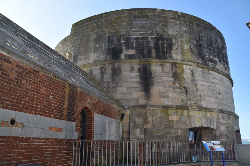
The Round Tower fortification, now museum. c1415. Ground floor reconstructed c1538-40. 2 upper storeys added probably late C17 by Sir Bernard de Gomme and remodified early C19, possibly for adaptation as a Martello Tower. Top raised and reconstructed and adapted as a gun platform c1850. Restored late C20. Ashlar stone. Roof asphalt paved. 3 storeys separated by stone string bands, lower storey projects. Cylindrical. Entrance facing Board Street has a 2-leaf panel door each leaf with a 6-pane glazed upper panel, set under a cambered stone arch. Facing the harbour on north and west sides are 3 gun ports each set under a flat segmental arch. 3 other gun ports were blocked up probably late C17 by Sir Bernard de Gomme. INTERIOR: rebuilt early C19 was reconstructed and has a large central stone column with brick vaulting, casements formed behind the surviving gun ports. (Balfour A: Portsmouth: London: 1970-: 15; Corney A: Fortifications in Old Portsmouth: Portsmouth City Museums: 1965-: 30, 31 AND 32; Lloyd DW: Buildings of Portsmouth and its Environs: Portsmouth: 1974-: 35,54-56,78,79,102; The Buildings of England: Pevsner N & Lloyd D: Hampshire and the Isle of Wight: Harmondsworth: 1967-: 422).
Listing NGR: SZ6292699463
External links are from the relevant listing authority and, where applicable, Wikidata. Wikidata IDs may be related buildings as well as this specific building. If you want to add or update a link, you will need to do so by editing the Wikidata entry.


Other nearby listed buildings