Latitude: 51.5016 / 51°30'5"N
Longitude: -0.0722 / 0°4'19"W
OS Eastings: 533904
OS Northings: 179830
OS Grid: TQ339798
Mapcode National: GBR WH.XX
Mapcode Global: VHGR0.PJP8
Plus Code: 9C3XGW2H+J4
Entry Name: Java Wharf
Listing Date: 1 July 1983
Grade: II
Source: Historic England
Source ID: 1385894
English Heritage Legacy ID: 471313
ID on this website: 101385894
Location: Wapping, Southwark, London, SE1
County: London
District: Southwark
Electoral Ward/Division: Riverside
Parish: Non Civil Parish
Built-Up Area: Southwark
Traditional County: Surrey
Lieutenancy Area (Ceremonial County): Greater London
Church of England Parish: Bermondsey St Mary Magdalen, St Olave, St John and St Luke
Church of England Diocese: Southwark
Tagged with: Architectural structure
SOUTHWARK
TQ3379 SHAD THAMES 636-1/5/684 (East side) 01/07/83 No.16 Java Wharf
GV II
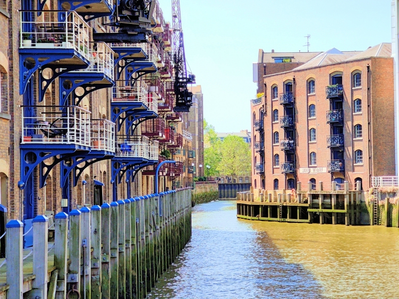
Warehouse, now flats. c1860-70, partly rebuilt C20. Much destroyed by fire and rebuilt behind facade as flats with similar dockside elevation. Stock brick with yellow and grey brick dressings and coped parapet. 5 storeys, 5 bay with elevation cranked with road line between bays 3 and 4. New ground floor. 2 hatch ranks above ground floor with segmental arches and bull-nosed engineering brick reveals, now adapted as balconies. Windows in segmental-arched, full-height recesses. INTERIOR: not inspected. The beginning of a particularly good surviving sequence of warehouses between Shad Thames and St Saviour's Dock (qqv).
Listing NGR: TQ3390479830
External links are from the relevant listing authority and, where applicable, Wikidata. Wikidata IDs may be related buildings as well as this specific building. If you want to add or update a link, you will need to do so by editing the Wikidata entry.


Other nearby listed buildings