Latitude: 51.4737 / 51°28'25"N
Longitude: -0.0637 / 0°3'49"W
OS Eastings: 534575
OS Northings: 176750
OS Grid: TQ345767
Mapcode National: GBR YT.TW
Mapcode Global: VHGR6.V752
Plus Code: 9C3XFWFP+FG
Entry Name: 2, Queens Road
Listing Date: 27 September 1972
Last Amended: 17 September 1998
Grade: II
Source: Historic England
Source ID: 1385793
English Heritage Legacy ID: 471205
ID on this website: 101385793
Location: Peckham, Southwark, London, SE15
County: London
District: Southwark
Electoral Ward/Division: Nunhead
Parish: Non Civil Parish
Built-Up Area: Southwark
Traditional County: Surrey
Lieutenancy Area (Ceremonial County): Greater London
Church of England Parish: Peckham St Mary Magdalene
Church of England Diocese: Southwark
Tagged with: Building
SOUTHWARK
TQ3476 QUEEN'S ROAD 636-1/12/611 (South side) 27/09/72 No.2 (Formerly Listed as: QUEEN'S ROAD (South side) Nos.2, 4, 4A, 6-10 (Even))
II
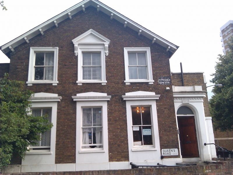
House. Early C19, with later extension. Brown brick with stucco dressings, porch and rusticated basement; pitched roof with overhanging bracketed eaves to gable front. 2 storeys and basement, 3 bays with 1-storey entrance extension to right. Porch with round-headed door with vermiculated keystone, dentil cornice and blocking course. 4-paned sash windows, those on ground-floor with stucco architraves and cornices, those on 1st floor with moulded stucco architraves and bracketed sills, the centre window with triangular pediment on console brackets. INTERIOR: not inspected.
Listing NGR: TQ3457576750
External links are from the relevant listing authority and, where applicable, Wikidata. Wikidata IDs may be related buildings as well as this specific building. If you want to add or update a link, you will need to do so by editing the Wikidata entry.


Other nearby listed buildings