Latitude: 51.5052 / 51°30'18"N
Longitude: -0.0888 / 0°5'19"W
OS Eastings: 532737
OS Northings: 180210
OS Grid: TQ327802
Mapcode National: GBR SG.6L
Mapcode Global: VHGR0.DFWF
Plus Code: 9C3XGW46+3F
Entry Name: Post Office
Listing Date: 27 September 1972
Grade: II
Source: Historic England
Source ID: 1378344
English Heritage Legacy ID: 470643
ID on this website: 101378344
Location: The Borough, Southwark, London, SE1
County: London
District: Southwark
Electoral Ward/Division: Grange
Parish: Non Civil Parish
Built-Up Area: Southwark
Traditional County: Surrey
Lieutenancy Area (Ceremonial County): Greater London
Church of England Parish: St Saviour with All Hallows Southwark
Church of England Diocese: Southwark
Tagged with: Post office
SOUTHWARK
TQ3280SE BOROUGH HIGH STREET 636-1/17/76 (East side) 27/09/72 No.19A Post Office
GV II
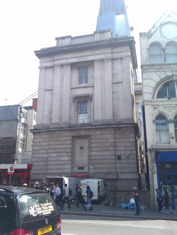
Formerly known as: Telephone Building at rear of No.4 LONDON BRIDGE STREET. Ward block of former St Thomas's Hospital, now post office. 1842-4. By Samuel Robinson and James Field. Portland stone, with channelled rustication to ground floor; slate roof. Late Georgian style, EXTERIOR: 3 storeys. 1-bay elevation to Borough High Street: blind window set in revealed square-headed architrave to centre of rusticated ground-floor with cornice; 2 upper floors, with 18-pane sashes set in moulded architraves with bracketed cornice to 1st floor and eared architrave to 2nd floor, are articulated by giant order of Doric pilasters surmounted by dentilled entablature, with raised parapet to centre. Similar side elevations (south one mainly obscured) of 3 storeys and basement, 1;3;1;3;1 bay pattern with projecting outer and central bays articulated by Doric pilasters. Ground-floor windows in revealed architraves; upper windows with eared architraves and sill band to 2nd floor; tripartite windows with Doric piers to projecting central bay with parapet. INTERIOR: not inspected. Built on part of the site of Court A of old St Thomas's Hospital as the southern of 2 large ward blocks (the other of which has gone), directly north of the former Church of St Thomas.
Listing NGR: TQ3271980209
External links are from the relevant listing authority and, where applicable, Wikidata. Wikidata IDs may be related buildings as well as this specific building. If you want to add or update a link, you will need to do so by editing the Wikidata entry.


Other nearby listed buildings