Latitude: 51.2336 / 51°14'0"N
Longitude: -0.334 / 0°20'2"W
OS Eastings: 516410
OS Northings: 149586
OS Grid: TQ164495
Mapcode National: GBR HGJ.LD4
Mapcode Global: VHGS7.5885
Plus Code: 9C3X6MM8+C9
Entry Name: Brookside
Listing Date: 11 June 1973
Grade: II
Source: Historic England
Source ID: 1378074
English Heritage Legacy ID: 289839
ID on this website: 101378074
Location: Dorking, Mole Valley, Surrey, RH4
County: Surrey
District: Mole Valley
Electoral Ward/Division: Dorking North
Parish: Non Civil Parish
Built-Up Area: Dorking
Traditional County: Surrey
Lieutenancy Area (Ceremonial County): Surrey
Church of England Parish: Dorking St Martin
Church of England Diocese: Guildford
Tagged with: Building
ARCHWAY PLACE 1. 1049 Brookside TQ 1649 NW 3/24A II
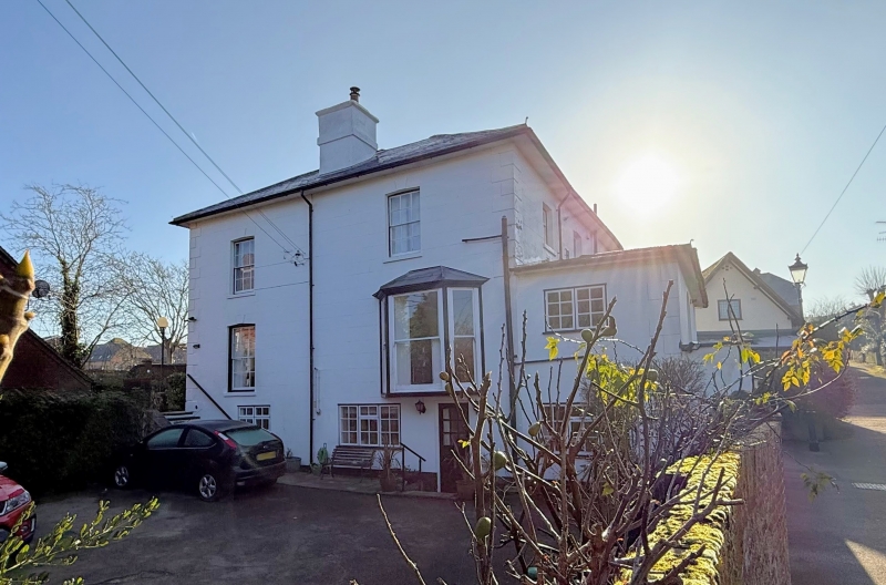
2. The original waterworks were situated here and in the cellars is part of one of the original pumps. On the west wall of the building is a plaque with the inscription "R P Waterworks erected 1738". Present building dates from early C19. Its principal front faces east. 2 storeys. 4 windows. Stuccoed. Long and short quoins. Wide eaves cornice. Hipped slate roof. Windows with Venetian shutters and glazing bars intact. Non-central doorway with fluted half-columns and flat hood over. Originally there was a verandah across the whole of the ground floor supported on fluted columns. But this has been removed and the columns re-erected in the garden. One ground floor room, probably the original hall then entered from the west, has 2 Ionic columns, forming a recess at its western end.
Listing NGR: TQ1641049586
External links are from the relevant listing authority and, where applicable, Wikidata. Wikidata IDs may be related buildings as well as this specific building. If you want to add or update a link, you will need to do so by editing the Wikidata entry.


Other nearby listed buildings