Latitude: 53.1854 / 53°11'7"N
Longitude: -2.8834 / 2°53'0"W
OS Eastings: 341064
OS Northings: 365736
OS Grid: SJ410657
Mapcode National: GBR 7B.3841
Mapcode Global: WH88F.P649
Plus Code: 9C5V54P8+5J
Entry Name: Manor House
Listing Date: 23 July 1998
Grade: II
Source: Historic England
Source ID: 1375911
English Heritage Legacy ID: 469890
ID on this website: 101375911
Location: Handbridge, Cheshire West and Chester, Cheshire, CH4
County: Cheshire West and Chester
Electoral Ward/Division: Handbridge Park
Parish: Non Civil Parish
Built-Up Area: Chester
Traditional County: Cheshire
Lieutenancy Area (Ceremonial County): Cheshire
Church of England Parish: Chester St Mary without the Walls
Church of England Diocese: Chester
Tagged with: House
CHESTER CITY (EM)
SJ4165 QUEEN'S PARK ROAD 1932-1/8/233 (South side) No.2 Manor House
GV II
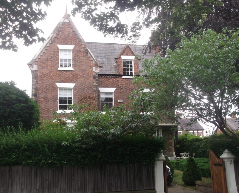
Detached suburban house. 1852. Flemish bond brown brick with steep gabled grey slate roofs. Tudor Revival style. EXTERIOR: 2 storeys plus attics; 3 windows, the left bay projecting with front gable. 3 steps to door of 2 tall panels in stone case with plinths, segmental arch to 1-pane overlight and coping in gabled brick porch with stone flush quoins and coping; a recessed 12-pane sash in projecting stone case with hipped stone roof, left; 3 stone steps to canted bay window, right, with stone plinth, pair of French windows with 3-pane sidelights and margin-paned overlight, with iron railing to balcony above; 2 Tudor-arched lights in right face of porch. Painted stone sills and gauged brick arches to 3 recessed 12-pane sashes to first floor. A recessed 12-pane sash to attic in gable of left bay and in a gabled dormer, right. Projecting square-arris quoins to corners; stone kneelers, copings and finials to gables. The sides are expressed similarly to the front. INTERIOR: intact, with a pleasing open-well open-string stair, 4-panel doors, some fireplaces, ceiling cornices. This item appears to be part of a planned development which included the cottages in Victoria Pathway, partly to its rear. The Manor House and the first two blocks of cottages are shown on John M'Gahey's pictorial plan of Chester published c1855. (M'Gahey J: Pictorial Map of Chester: Chester: 1855-).
Listing NGR: SJ4106465736
External links are from the relevant listing authority and, where applicable, Wikidata. Wikidata IDs may be related buildings as well as this specific building. If you want to add or update a link, you will need to do so by editing the Wikidata entry.


Other nearby listed buildings