Latitude: 53.186 / 53°11'9"N
Longitude: -2.8893 / 2°53'21"W
OS Eastings: 340670
OS Northings: 365802
OS Grid: SJ406658
Mapcode National: GBR 7B.36N9
Mapcode Global: WH88F.L5BW
Plus Code: 9C5V54P6+97
Entry Name: Pumping Station
Listing Date: 23 July 1998
Grade: II
Source: Historic England
Source ID: 1375736
English Heritage Legacy ID: 469715
ID on this website: 101375736
Location: Chester, Cheshire West and Chester, Cheshire, CH4
County: Cheshire West and Chester
Electoral Ward/Division: Chester City
Parish: Non Civil Parish
Built-Up Area: Chester
Traditional County: Cheshire
Lieutenancy Area (Ceremonial County): Cheshire
Church of England Parish: Chester St John the Baptist
Church of England Diocese: Chester
Tagged with: Pumping station Hydroelectric power station
CHESTER CITY (EM)
SJ4065 CASTLE DRIVE 1932-1/8/32 (South side) Pumping Station
II
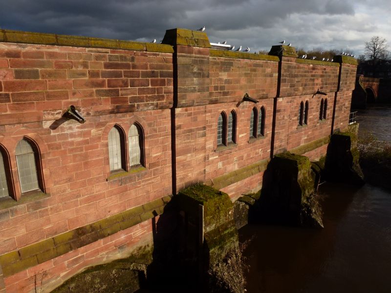
Hydro-electric generating station, now water company's pumping station. 1912-13. For Chester City Council, whose Electrical Engineer was SE Britton: consultant engineer for the hydro-electric station AC Hurtzig; proposed building designed under supervision of SE Britton, but re-design more harmonious with the adjoining Old Dee Bridge prepared by the Chester and North Wales Architectural Society (accepted by the Electricity Committee 1.5.1912). Coursed tooled red sandstone. EXTERIOR: one storey to Castle Drive, flat roof. The simple front has unpierced stone face to generator hall inscribed in raised letters on a long stone panel CITY OF CHESTER HYDRO-ELECTRIC POWER STATION : A.D. MCMXIII. A small ashlar entrance tower, right, has oak 3-leaf folding doors of 3 fielded panels in a Tudor-arched opening; stone parapet. The west side to the river has leaded lancet in tower, 3 buttressed bays with a pointed-arched spillway in the first and recessed pointed-arched panels of stone in the second and third; a weathered string; 2 pairs of leaded lancets to each bay; a shorter blank end-bay. The east side is similarly expressed, but with steel eel-traps to inlets and steel walkway. The south end has a massive walkway-plinth with sluice, right. Above the plinth a pair of boarded oak doors with postern in a broad pointed archway. INTERIOR not inspected. The power station stands on the site of the medieval Mills of Dee. (Chester City Council and Committees: Electricity and Improvement Committee Minutes: 1911-1913: PASSIM).
Listing NGR: SJ4067065802
External links are from the relevant listing authority and, where applicable, Wikidata. Wikidata IDs may be related buildings as well as this specific building. If you want to add or update a link, you will need to do so by editing the Wikidata entry.


Other nearby listed buildings