Latitude: 52.5347 / 52°32'4"N
Longitude: -2.4188 / 2°25'7"W
OS Eastings: 371685
OS Northings: 293061
OS Grid: SO716930
Mapcode National: GBR BZ.FF6P
Mapcode Global: VH90Z.1K38
Plus Code: 9C4VGHMJ+VF
Entry Name: 3, Waterloo Terrace
Listing Date: 1 February 1974
Grade: II
Source: Historic England
Source ID: 1374842
English Heritage Legacy ID: 254562
ID on this website: 101374842
Location: Bridgnorth, Shropshire, WV16
County: Shropshire
Civil Parish: Bridgnorth
Built-Up Area: Bridgnorth
Traditional County: Shropshire
Lieutenancy Area (Ceremonial County): Shropshire
Church of England Parish: Bridgnorth
Church of England Diocese: Hereford
Tagged with: Building
1. 1954 BRIDGNORTH WATERLOO TERRACE
No 3 SO 79 SW 2/238
II GV
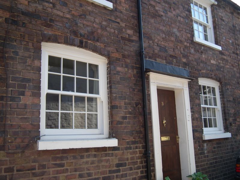
2. C18 and later, the fabric probably earlier. Painted brick; 2 storeys plus attic; 2 C19 sash windows with single glazing bars; 2 modern brick gabled dormers; dentilled eaves; old tiles. C19 moulded wood pilaster doorcase on left-hand side. Modern shop front. Included for group value. Nos 1 to 8 (consec) form a group
Listing NGR: SO7168593061
External links are from the relevant listing authority and, where applicable, Wikidata. Wikidata IDs may be related buildings as well as this specific building. If you want to add or update a link, you will need to do so by editing the Wikidata entry.


Other nearby listed buildings