Latitude: 53.0671 / 53°4'1"N
Longitude: -2.5193 / 2°31'9"W
OS Eastings: 365297
OS Northings: 352331
OS Grid: SJ652523
Mapcode National: GBR 7T.BSMH
Mapcode Global: WH9BB.85KJ
Plus Code: 9C5V3F8J+R7
Entry Name: Congregational Chapel
Listing Date: 1 March 1974
Grade: II
Source: Historic England
Source ID: 1373912
English Heritage Legacy ID: 431245
ID on this website: 101373912
Location: Nantwich, Cheshire East, Cheshire, CW5
County: Cheshire East
Civil Parish: Nantwich
Built-Up Area: Nantwich
Traditional County: Cheshire
Lieutenancy Area (Ceremonial County): Cheshire
Church of England Parish: Nantwich St Mary
Church of England Diocese: Chester
Tagged with: House Church building
This list entry was subject to a Minor Amendment on 3 February 2025 to reformat the text to current standards.
SJ 6552
1/130
MONKS LANE
Congregational Chapel
II
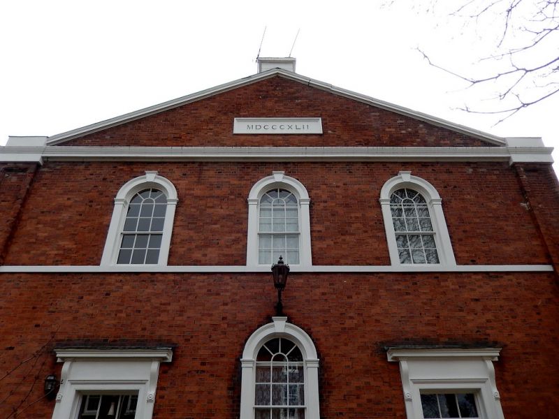
Dated 1841. Red brick with stone dressings; two storeys; three windows with Roman arched heads. Ground storey has central window, two moulded pilaster doorcases with cornices on consoles, stone and three-stepped perron overall; large panelled pilasters at sides supporting pediment having stone panel inscribed with above date. No longer in use.
Listing NGR: SJ6529752331
This list entry was subject to a Minor Amendment on 3 February 2025 to reformat the text to current standards.
SJ 6552
1/130
MONKS LANE
Congregational Chapel
II
Dated 1841. Red brick with stone dressings; two storeys; three windows with Roman arched heads. Ground storey has central window, two moulded pilaster doorcases with cornices on consoles, stone and three-stepped perron overall; large panelled pilasters at sides supporting pediment having stone panel inscribed with above date. No longer in use.
Listing NGR: SJ6529752331
External links are from the relevant listing authority and, where applicable, Wikidata. Wikidata IDs may be related buildings as well as this specific building. If you want to add or update a link, you will need to do so by editing the Wikidata entry.


Other nearby listed buildings