Latitude: 51.2728 / 51°16'22"N
Longitude: 1.1665 / 1°9'59"E
OS Eastings: 620963
OS Northings: 157394
OS Grid: TR209573
Mapcode National: GBR VZQ.1QQ
Mapcode Global: VHLGP.58JL
Plus Code: 9F3375F8+4H
Entry Name: Corner Cottage
Listing Date: 14 March 1980
Grade: II
Source: Historic England
Source ID: 1372870
English Heritage Legacy ID: 171292
ID on this website: 101372870
Location: Littlebourne, Canterbury, Kent, CT3
County: Kent
District: Canterbury
Civil Parish: Littlebourne
Built-Up Area: Littlebourne
Traditional County: Kent
Lieutenancy Area (Ceremonial County): Kent
Tagged with: Cottage
1. 5273 LITTLEBOURNE HIGH STREET (north-east side)
Nos 6 and 8 TR 2057 35/457
II GV
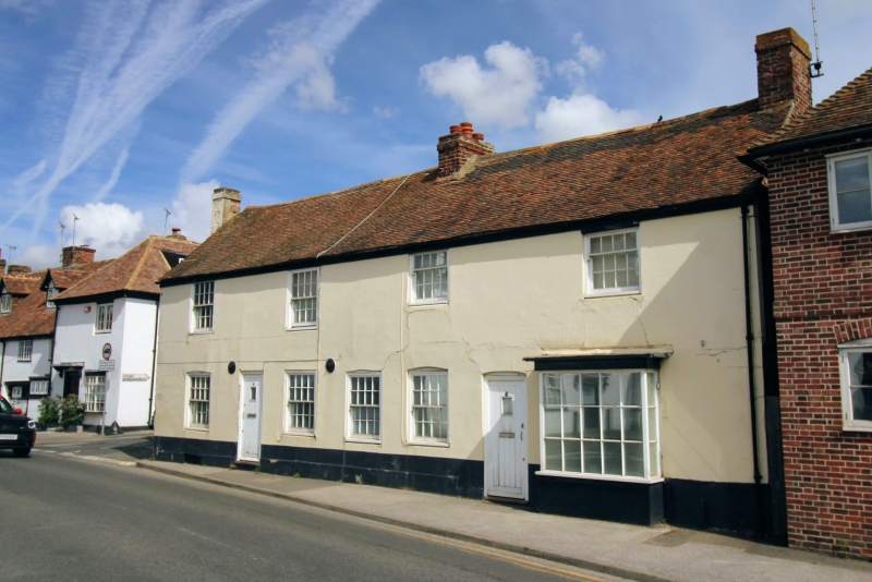
2. Includes No 2 Nargate Street C18. Two storeys stuccoed. Tiled roof. Four windows in all. Some sashes with glazing bars intact, some with verticals only and some modern windows. No 6 has a bay window, cambered arches and circular iron ties. No 2 Nargate Street has a doorcase in the side elevation.
Listing NGR: TR2096057396
External links are from the relevant listing authority and, where applicable, Wikidata. Wikidata IDs may be related buildings as well as this specific building. If you want to add or update a link, you will need to do so by editing the Wikidata entry.


Other nearby listed buildings