Latitude: 53.0525 / 53°3'8"N
Longitude: -1.0641 / 1°3'50"W
OS Eastings: 462832
OS Northings: 350987
OS Grid: SK628509
Mapcode National: GBR 9HV.MSD
Mapcode Global: WHFHK.MJHS
Plus Code: 9C5W3W2P+X9
Entry Name: Orchard Farmhouse
Listing Date: 13 May 1986
Grade: II
Source: Historic England
Source ID: 1370193
English Heritage Legacy ID: 242193
ID on this website: 101370193
Location: Oxton, Newark and Sherwood, Nottinghamshire, NG25
County: Nottinghamshire
District: Newark and Sherwood
Civil Parish: Oxton
Built-Up Area: Oxton
Traditional County: Nottinghamshire
Lieutenancy Area (Ceremonial County): Nottinghamshire
Church of England Parish: Oxton
Church of England Diocese: Southwell and Nottingham
Tagged with: Farmhouse
SK 65 SW OXTON EPPERSTONE ROAD (east side)
6/137 Orchard Farmhouse
II
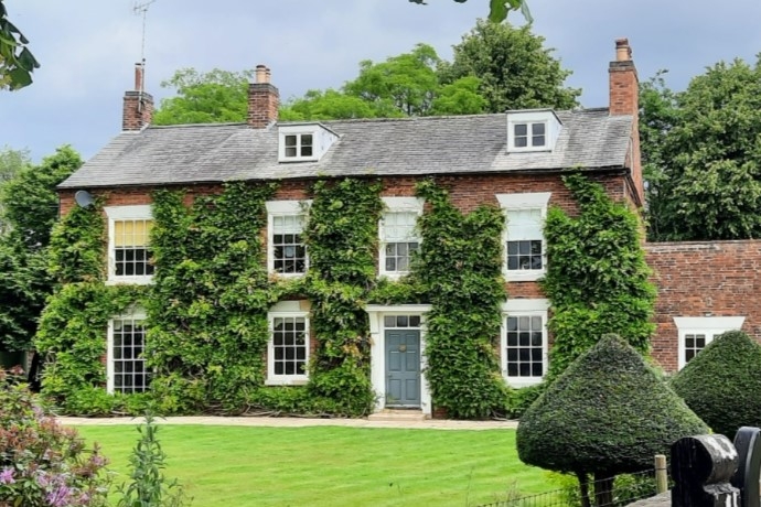
Farmhouse. Mid C18, C20 extensions. Red brick. Slate roof. 2 gable and single ridge red brick stacks. Dentil eaves. 2 storeys plus attic, 4 bays. The left single bay being C20. C18 house with central doorway with plank door and glazing bar overlight. Open brick and wood and plain tile porch. Either side are single glazing bar sashes with painted flush wedge lintels. Above are 3 similar sashes and lintels. In the attic are 2 wood and lead flat topped dormers each with single casement. Between the 2 first floor right windows is a single insurance plaque. The extension to the left has a single low glazing bar sash and a single similar smaller sash above, both with similar lintels.
Listing NGR: SK6283250987
External links are from the relevant listing authority and, where applicable, Wikidata. Wikidata IDs may be related buildings as well as this specific building. If you want to add or update a link, you will need to do so by editing the Wikidata entry.


Other nearby listed buildings