Latitude: 53.211 / 53°12'39"N
Longitude: -0.9031 / 0°54'11"W
OS Eastings: 473351
OS Northings: 368774
OS Grid: SK733687
Mapcode National: GBR BHG.LJ0
Mapcode Global: WHFGW.3K67
Plus Code: 9C5X636W+9Q
Entry Name: Island Farmhouse
Listing Date: 28 April 1986
Grade: II
Source: Historic England
Source ID: 1370134
English Heritage Legacy ID: 241874
ID on this website: 101370134
Location: Egmanton, Newark and Sherwood, Nottinghamshire, NG22
County: Nottinghamshire
District: Newark and Sherwood
Civil Parish: Egmanton
Built-Up Area: Egmanton
Traditional County: Nottinghamshire
Lieutenancy Area (Ceremonial County): Nottinghamshire
Church of England Parish: Egmanton
Church of England Diocese: Southwell and Nottingham
Tagged with: Farmhouse
EGMANTON MAIN STREET SK 76 NW (south side) 4/24 Island Farm House
II
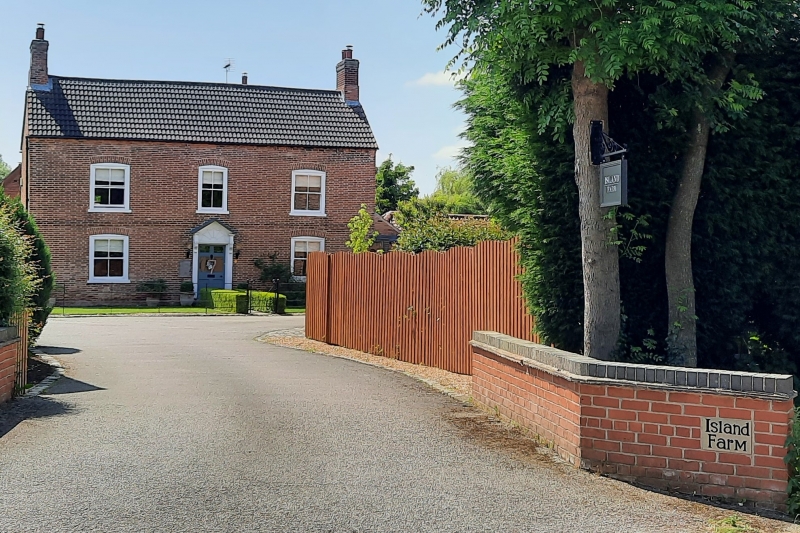
Farmhouse. Late C18. Brick with C20 pantile roof. Brick plinth, first floor band, dentillated eaves, 2 gable and single ridge stacks. 2 storeys plus garrets, 3 bays. L-plan with additions. Windows are mostly C19 plain and glazing bar sashes. North front has central panelled timber doorcase with carved brackets carrying entablature and dentillated pedimented hood containing dummy fanlight. Recessed panelled part glazed C18 door. Flanked by single sashes. Above, smaller central sash, flanked by single sashes. All front sashes have segmental rubbed brick heads. West side has, to left, door flanked by single sashes. To its right, 2 sashes, one with square head, and to right, C20 casement. All with segmental heads. Above again, to left, casement with segmental rubbed brick head. East gable has, to left, sash with segmental head. Above, to garret, Yorkshire sash with segmental head. South end has C20 door flanked to left by C20 casement and to right by small sash.
Listing NGR: SK7335168774
External links are from the relevant listing authority and, where applicable, Wikidata. Wikidata IDs may be related buildings as well as this specific building. If you want to add or update a link, you will need to do so by editing the Wikidata entry.


Other nearby listed buildings