Latitude: 53.0797 / 53°4'46"N
Longitude: -0.9116 / 0°54'41"W
OS Eastings: 473003
OS Northings: 354162
OS Grid: SK730541
Mapcode National: GBR BJZ.Y24
Mapcode Global: WHFHF.ZV1D
Plus Code: 9C5X33HQ+V8
Entry Name: Upton Grange and Attached Walls
Listing Date: 19 September 1985
Grade: II
Source: Historic England
Source ID: 1369998
English Heritage Legacy ID: 242829
ID on this website: 101369998
Location: The Green, Newark and Sherwood, Nottinghamshire, NG23
County: Nottinghamshire
District: Newark and Sherwood
Civil Parish: Upton
Built-Up Area: Upton
Traditional County: Nottinghamshire
Lieutenancy Area (Ceremonial County): Nottinghamshire
Church of England Parish: Upton
Church of England Diocese: Southwell and Nottingham
Tagged with: Architectural structure
SK 75 SW MAIN ROAD (south side) 8/125 Upton Grange and attached walls II
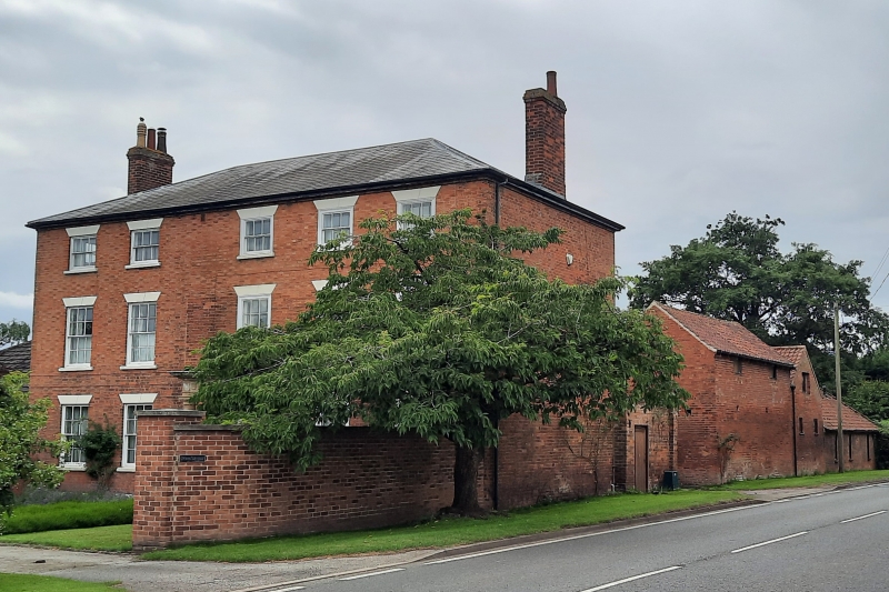
House. Late C18, raised and enlarged early C19. Brick with hipped slate roof. Cogged eaves. 4 side wall stacks. 3 storeys, 5 bays. Square plan. Windows are glazing bar sashes with rubbed brick heads and splayed rendered lintels. Main east front has central porch with fluted Doric columns and antae, foliate frieze, cornice with guttae, flat lead roof. C19 door with glazing bar overlight. Flanked by 2 sashes and to left, 2 basement windows. Above, 5 sashes and above again, 5 smaller sashes. Rear elevation has mainly C20 fenestration. Adjoining boundary wall, to street, brick with stone coping, has 2 panelled square gate piers with concave pyramidal caps. Approx. 50 M long. Adjoining garden wall, brick with ramped stone coping, has single gate pier with pyramidal cap and 2 re-sited rainwater heads inscribed 'I W' and '1834'. Approx. 15 M long.
Listing NGR: SK7300354162
External links are from the relevant listing authority and, where applicable, Wikidata. Wikidata IDs may be related buildings as well as this specific building. If you want to add or update a link, you will need to do so by editing the Wikidata entry.


Other nearby listed buildings