Latitude: 51.645 / 51°38'42"N
Longitude: -1.0041 / 1°0'14"W
OS Eastings: 469006
OS Northings: 194494
OS Grid: SU690944
Mapcode National: GBR B1Y.YRG
Mapcode Global: VHDVT.KX19
Plus Code: 9C3WJXWW+29
Entry Name: Lloyds Bank
Listing Date: 18 July 1963
Last Amended: 11 December 1985
Grade: II
Source: Historic England
Source ID: 1369038
English Heritage Legacy ID: 247685
ID on this website: 101369038
Location: Watlington, South Oxfordshire, OX49
County: Oxfordshire
District: South Oxfordshire
Civil Parish: Watlington
Built-Up Area: Watlington
Traditional County: Oxfordshire
Lieutenancy Area (Ceremonial County): Oxfordshire
Church of England Parish: Watlington
Church of England Diocese: Oxford
Tagged with: Bank building
WATLINGTON SHIRBURN STREET SU6994 (East side) 7/212 No.2 (Lloyds Bank) 18/07/63 (Formerly listed as Lloyds Bank)
GV II
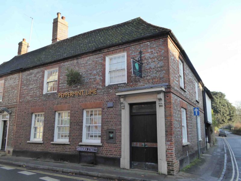
House, now bank and flat. Late C18, C17 building to rear. Mainly grey English bond brick with red brick dressings; ground floor of front rebuilt in C20 brick. Gabled old tile roof, hipped to right side; brick end stacks. Plan form not determined. 2 storeys; 2-window range. C20 flat hood over C20 door. C20 gauged brick flat arches over sashes; similar 2-window range with storey band to right side. C17 two-storey, one-bay building to rear: right side wall has roughcast fir.st flour jettied over timber framed ground floor with C19 six-panelled door and 3-light casement. Interior: mid C18 cornices. Chamfered beam to rear. First floor not inspected but likely to be of interest.
Listing NGR: SU6900894498
External links are from the relevant listing authority and, where applicable, Wikidata. Wikidata IDs may be related buildings as well as this specific building. If you want to add or update a link, you will need to do so by editing the Wikidata entry.


Other nearby listed buildings